
Share

Copied
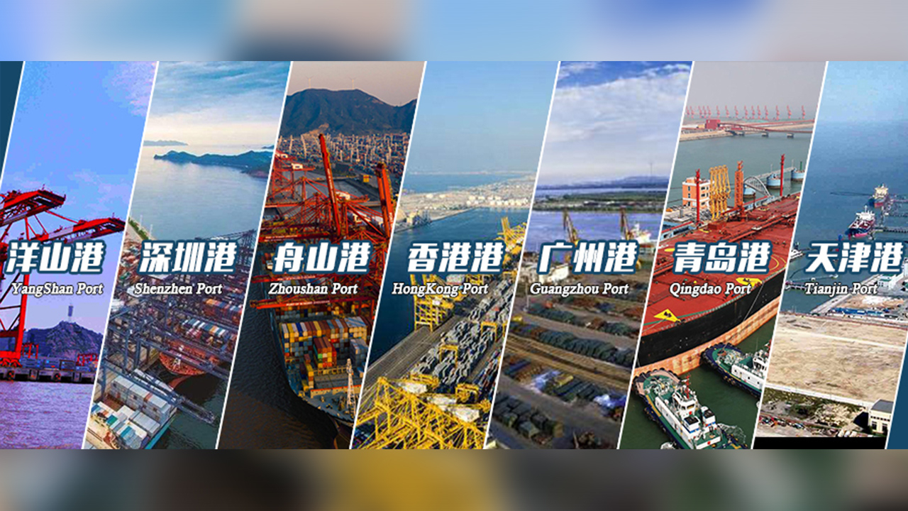
China released the latest satellite images of its major ports on July 11, the country's 15th National Maritime Day.
In recent years, China's major ports have registered some impressive container throughput figures. Based on the number released by the Ministry of Transport (MOT), among the world's top ten ports with the largest cargo and container throughput, seven are in China.
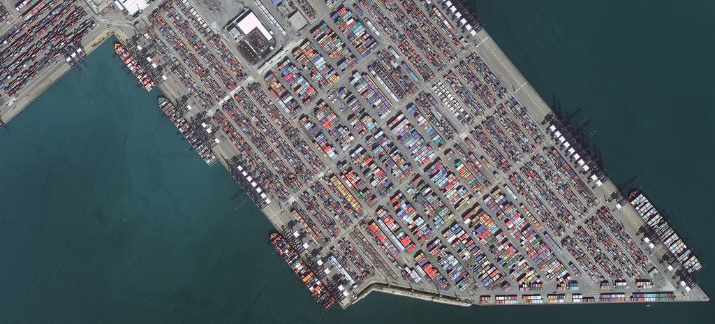
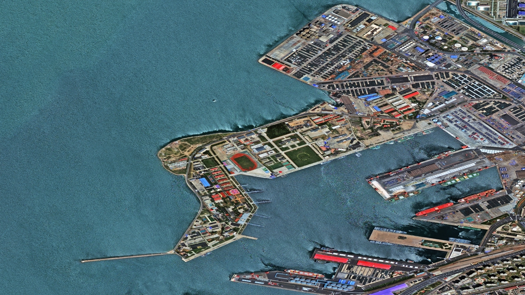
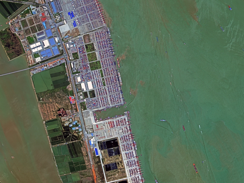
China has the world's largest cargo and container throughput for the past 16 years. Satellite images released on Thursday includes some of China's major ports: Yangshan Port of Shanghai, Shenzhen Port, Zhoushan Port of Ningbo, Hong Kong Port, Guangzhou Port, Qingdao Port and Tianjin Port.
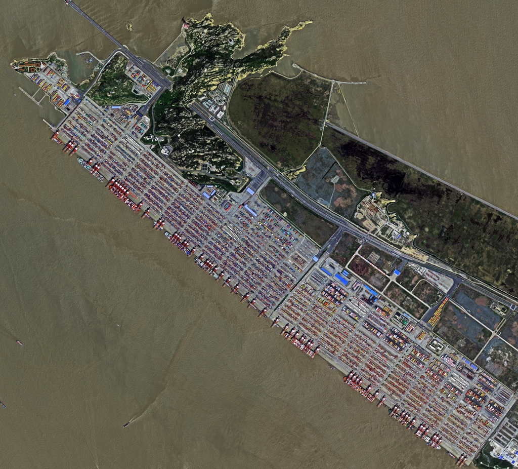
Yangshan Port of Shanghai
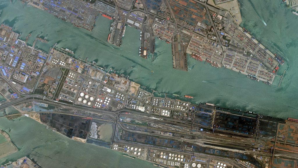
Tianjin Port
Shenzhen Port
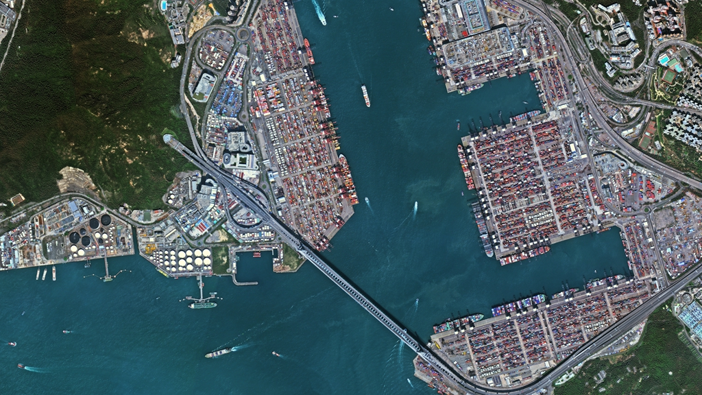
Hong Kong Port
Qingdao Port
Guangzhou Port
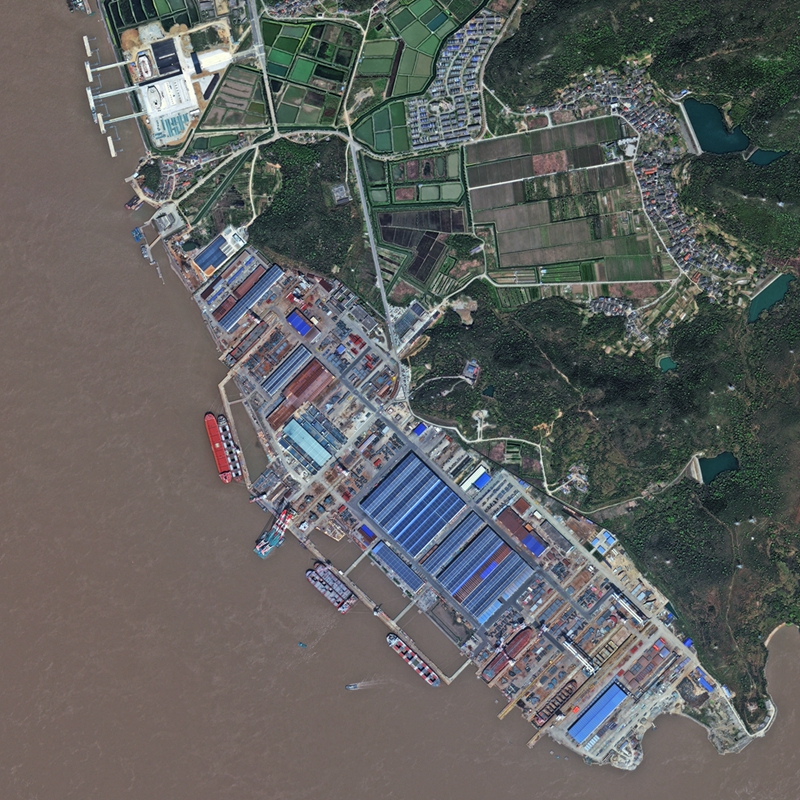
Zhoushan Port of Ningbo
As of how to achieve that target, MOT mentioned six key guidelines: creativity, coordination, green, open, sharing, and safety.
As an example of reform and openness in shipping industry, according to Yi Xiyong, deputy director of Water Transport Bureau of MOT, China has removed provisions on the limits to the ratio of foreign investment in the international shipping industry and its ancillary industries.
In promoting environmentally friendly shipping, China is also boosting the construction of intelligent ports focusing on automated container ports. The application of AI, 5G and Beidou Navigation Satellite System is also being introduced to maritime transport.
The images were taken by China's Gaofen-2 (GF2) satellite, launched on August 19, 2014. The satellite has meter-class spatial resolution, high radiation accuracy, high positioning accuracy and rapid attitude maneuverability.
Editor notes: Satellite images provided by China Center For Resources Satellite Data and Applications, partial information is provided by China High Resolution Earth Observation System