
Share

Copied
Data from NASA's Atmospheric Infrared Sounder (AIRS) instruments maps the movement of carbon monoxide high in the atmosphere associated with the Amazon forest fire in Brazil.
The carbon monoxide generated from the forest fire plumes has reached an altitude of 18,000 feet (or 5,500 meters) since Aug 22, 2019. As time series shows, the carbon monoxide masses grow in the northwest Amazon region, and then drifts in a more concentrated plume toward the southeastern part of Brazil.
The pollutant after burning can travel a large distance, within which the carbon monoxide can persist in the atmosphere for about a month long.
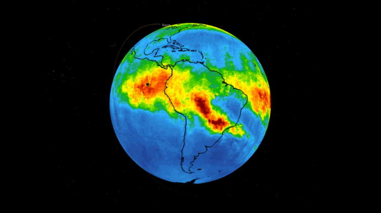
In the map, green indicates concentrations of carbon monoxide at approximately 100 parts per billion by volume (ppbv); yellow, at about 120 ppbv; and red at about 160 ppbv. /Screencut from NASA official website
Carbon monoxide plays a role in both air pollution and climate change. Although the pollutant at that moment has little effect on the air we breath, as the polluted air drifts over a relative high altitude, there is the possibility that strong winds may carry it downward where it can mix with the air we breath and therefore damage our health sooner or later.
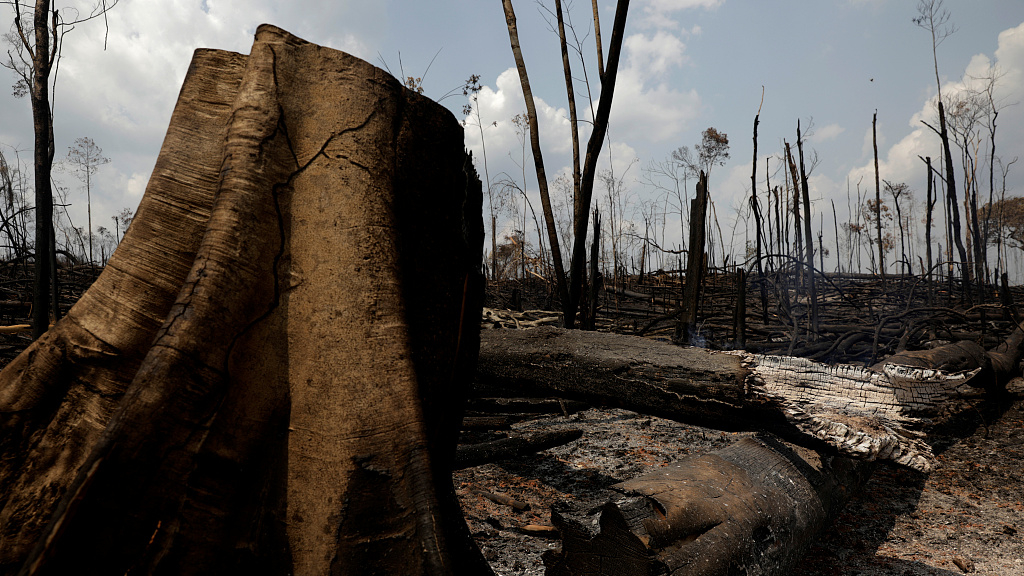
There are frequent fires in Brazil during dry seasons annually, but the fires this year are more widespread. According to Brazilian state specialists, roughly 77,000 wildfires across the nation over so far this year, increasing about 85 percent compared to the similar period in 2018.
The Amazon forest, hailed as the "Earth's lungs", produces about 20 percent of the world's oxygen. Now, the Amazon fire has become a global issue that has raised tensions worldwide.