- Home
- China
- World
- Europe
- Politics
- Business
- Opinions
- Tech & Sci
- Culture
- Sports
- Travel
- Nature
- Picture
- Video
- Live
- TV
- Specials

Share

Copied
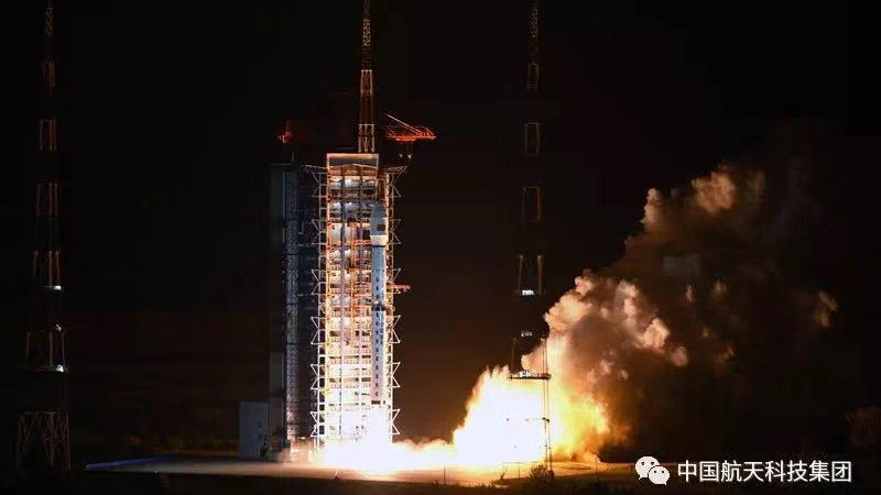
Photo via CASTC
China's Long March 4C carrier rocket has successfully sent a new remote sensing satellite into space on Saturday from Taiyuan Satellite Launch Center in north China's Shanxi Province.
The microwave satellite, named Gaofen-10, is part of China High-definition Earth Observation System (CHEOS) designed to facilitate climate surveying, urban planning, disaster response, precision agriculture mapping, and road network design.
It is capable of providing photographs with a resolution of less than a meter, which means a pixel on a Gaofen-10 photo could represent a less than 1-square meter area on the ground.
You may see that as "just another Chinese sat." But for China, Gaofen is a critical project which not only saves an astonishing amount of money, but also frees the country from Western control on geographic data.
Read more: Why Gaofen satellites are important to China
Looking back to Gaofen series
Developed by China Aerospace Science and Technology Corporation (CASTC), Gaofen satellites project is established as a national plan to build China's own earth observation system.
The system is expected to form an all-time, all-weather global surveillance network consisting of spatial observation system, ground and aerial observation platforms, stratosphere airships system, and application system.
Since the project began in 2010, China has had an increasingly clearer view of the planet. Launched in April 2013, Gaofen-1 can cover the globe in just four days. Gaofen-2, sent into space in August 2014, is accurate to 0.8 meters in full color and can collect multispectral images of objects greater than 3.2 meters in length.
In 2015 and 2016, another two Gaofen satellites have been successively sent into the orbit to form constellation with former ones.