- Home
- China
- World
- Asia-Pacific
- Americas
- Europe
- Middle-East and Africa
- Politics
- Business
- Opinions
- Tech & Sci
- Culture
- Sports
- Travel
- Nature
- Picture
- Video
- Live
- TV
- Specials

Share

Copied
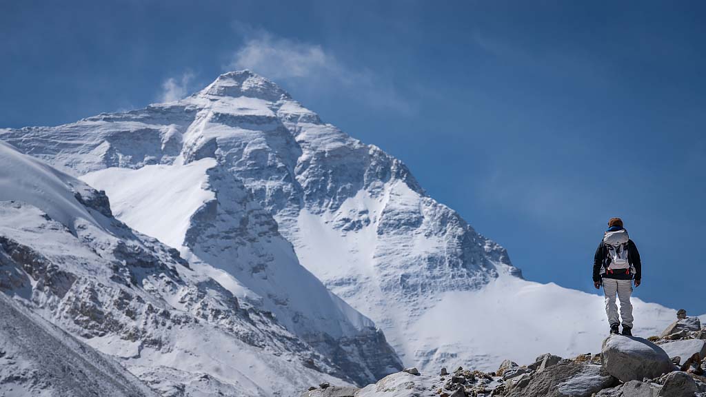
The world's highest mountain is now officially a little higher, but that might not be the end of the story.
China and Nepal agreed this week on a new standard height for Mount Qomolangma, the Himalayan peak that straddles their border.
As definitive as that sounds, with geological changes, the complicated business of measuring a mountain and varying criteria for determining the world's highest peak will likely ensure the question isn't settled for good.
Geological ups and downs
The mountain's height changes over time. The movement of tectonic plates can lift it up ever so gradually, while earthquakes can bring it down.
Data shows Mount Qomolangma rose about 0.4 centimeters annually from 2005 to 2015, citing Dang Yamin, a member of a Chinese team that surveyed the mountain's height earlier this year. However, a massive earthquake in 1934 wiped out 150 years of steady height increase in a few moments.
The countervailing forces may help maintain a degree of stability over time, said Dang, adding that nature tends to strike a balance.
Measuring mountains
There's more than one way to measure a mountain.
Last year, a Nepalese team set up a satellite navigation marker on Mount Qomolangma's peak to gauge its exact position via GPS satellites. A Chinese team undertook a similar mission this spring using the Chinese-made BeiDou Satellite Navigation System, along with other equipment.
Chinese officials said they had also conducted an airborne gravity survey, which uses an airborne gravimeter to measure the density of the ground that the plane is passing over. Surveyors can then get a much more accurate rendering of the topography, including the height of the hills, mountains, and valleys below.
The equipment, according to the survey team, can provide centimeter-level accuracy.
At the same time, the Nepalese crew took measurements with modern, laser-equipped versions of instruments called theodolites, which was first used to gauge the mountain's height in 1856 by measuring angles using trigonometry.
The Nepalese team also used ground penetrating radar to measure the amount of snow and ice that sits on top of its highest rock.
In previous measurements, both sides differed over whether to add the snow cap into the height. Nepalese officials argued the snow on top of the summit should be included, while figures given out by Chinese authorities are based on the height just measured to its highest rock.
This time, China and Nepal reached a consensus on counting the snow cap. They jointly announced a new official figure of 8,848.86 meters (29,031.69 feet).
"But, if there is a heavy snowfall on the peak the next day, the snow height will be much higher than the day before. The weather is constantly changing on the peak, so the result could only reflect the height on the day that scientists mounted," Dang later explained.
Why the measurement matters
"Data collected from multiple measurements can provide scientists the latest and first-hand resources for human's research on climate change, glacier monitoring, and ecological conservation," said Dang, in an interview with CCTV.
As Asia's water tower, Mount Qomolangma has a profound impact on the surrounding area. The region's tectonic movement, glacier changes can serve as key indicators for the climate study, he added.
(With input from AP)