- Home
- China
- World
- Asia-Pacific
- Americas
- Europe
- Middle-East and Africa
- Politics
- Business
- Opinions
- Tech & Sci
- Culture
- Sports
- Travel
- Nature
- Picture
- Video
- Live
- TV
- Radio
- Specials
- Learn Chinese

Share

Copied
The Pacific island nation of Tonga has suffered widespread damage after a huge underwater volcanic eruption and tsunami on the weekend.
Hunga Tonga-Hunga Ha'apai, on which the volcanic eruption occurred, was an uninhabited young island that emerged a little over seven years ago and has been ripped apart by the eruption.
The collection of satellite images below shows the geographical changes that have documented the history of the nascent island.
An image captured by Chinese satellite Gaofen-1 04 shows the island as it was on April 30, 2019.
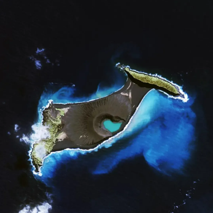
Image captured on April 30, 2019 shows the full shape of Hunga Tonga-Hunga Ha'apai. /China Center for Resources Satellite Data and Application
Another image captured Monday by Gaofen-1 02 shows the same area where Hunga Tonga-Hunga Ha'apai was once located.

The zone marked in red shows the same area where Hunga Tonga-Hunga Ha'apai was once located, January 17, 2022. /China Center for Resources Satellite Data and Application
Experts said the volcano, which last erupted in 2014, had been puffing away for about a month before rising magma, superheated to around 1,000 degrees Celsius, met with 20-degree seawater on Saturday, causing an instantaneous and massive explosion.
On January 7, a Planet SkySat satellite image showed a stream of smoke soaring into the air from the undersea volcano. Two hours before the volcanic eruption on Saturday, the middle part of Hunga Tonga-Hunga Ha'apai had already vanished.
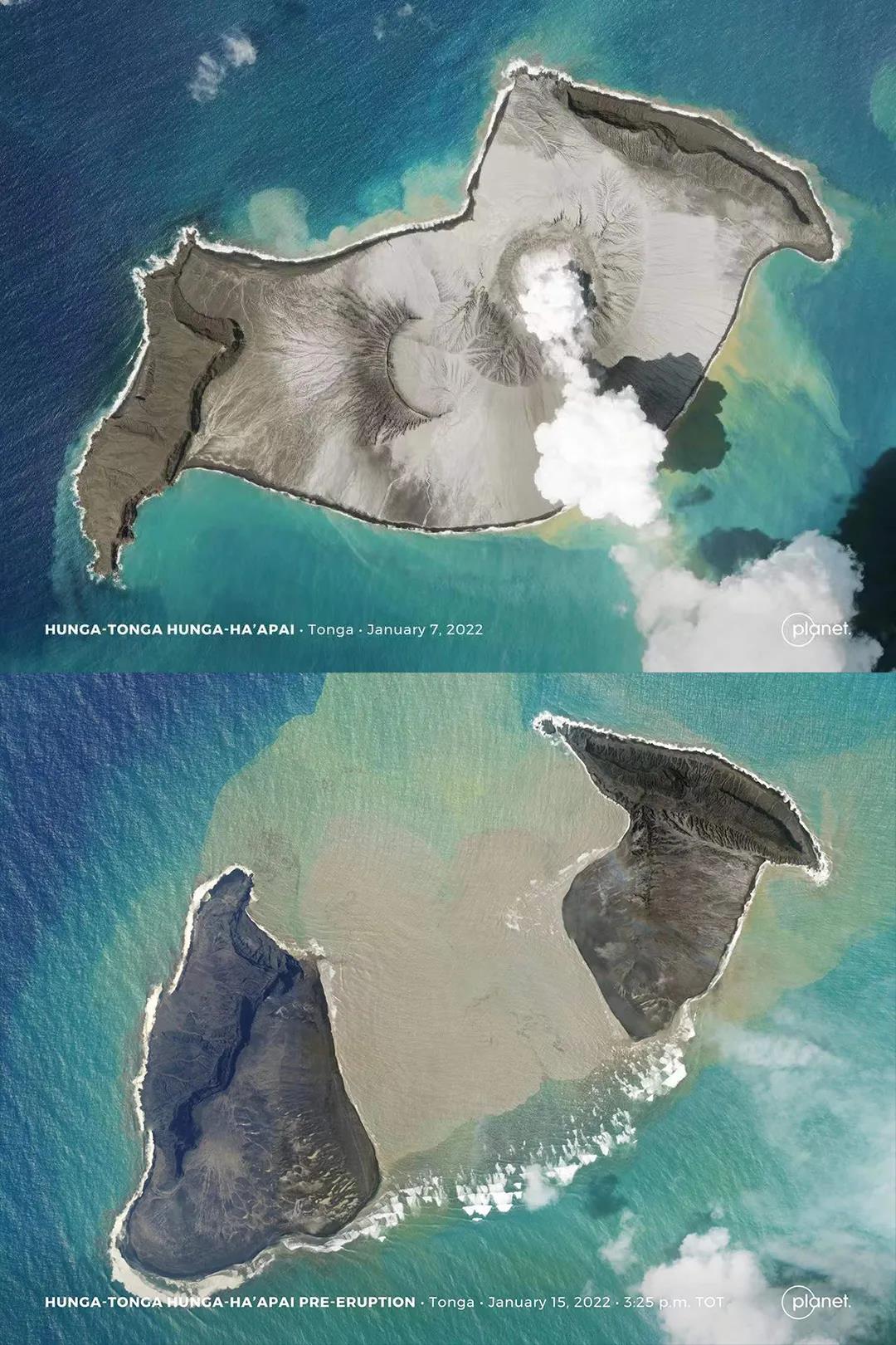
Imagery showing the area where the volcano erupted on January 7 and January 15, 2022 /Planet SkySat
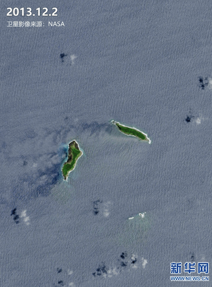
The island, which once sat on the seismically active Pacific Ring of Fire, was the product of the merging of two small islands, one named Hunga Tonga and the other Hunga Ha'apai. The merger was caused after the same volcano erupted in December 2014. The two islands had been separated by the Pacific Ocean, as shown by imagery captured on December 2, 2013.
The twin islands that formed Hunga Tonga-Hunga Ha'apai are now separate again and much reduced in size.
Three people have been confirmed dead in the disaster, Tonga's government reported Tuesday. Internet and telephone communications are extremely limited in the country, and outlying coastal areas remain cut off.
(With input from agencies)