- Home
- China
- World
- Asia-Pacific
- Americas
- Europe
- Middle-East and Africa
- Politics
- Business
- Opinions
- Tech & Sci
- Culture
- Sports
- Travel
- Nature
- Picture
- Video
- Live
- TV
- Radio
- Specials
- Learn Chinese

Share

Copied
The Antelope Canyon is a famous site for landscape photography. The magnificent canyon was formed by the erosion of Navajo Sandstone due to flash flooding and rainwater. When the settlers first came out here, they found that antelopes, elk and deer were roaming in the place, thus named it "Antelope Canyon."
The canyon is about 15 minutes away from the city of Page adjacent to the Navajo Nation, the United States' largest Native American tribe. There are five scenic spots that you can visit. Upper Antelope Canyon, Rattle Snake Canyon, Owl Canyon, Mountain Sheep Canyon and Lower Antelope Canyon. In Navajo language, the name for Upper Antelope Canyon means "the place where water runs through rocks," and the name for Lower Antelope Canyon means "spiral rock arches." Both names vividly describes the undulating rocks in the canyon.
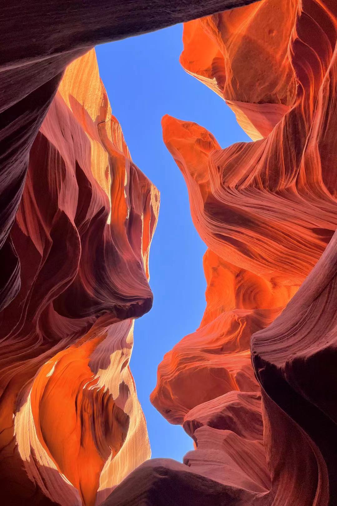
Antelope Canyon. /Courtesy of Wan Hailun
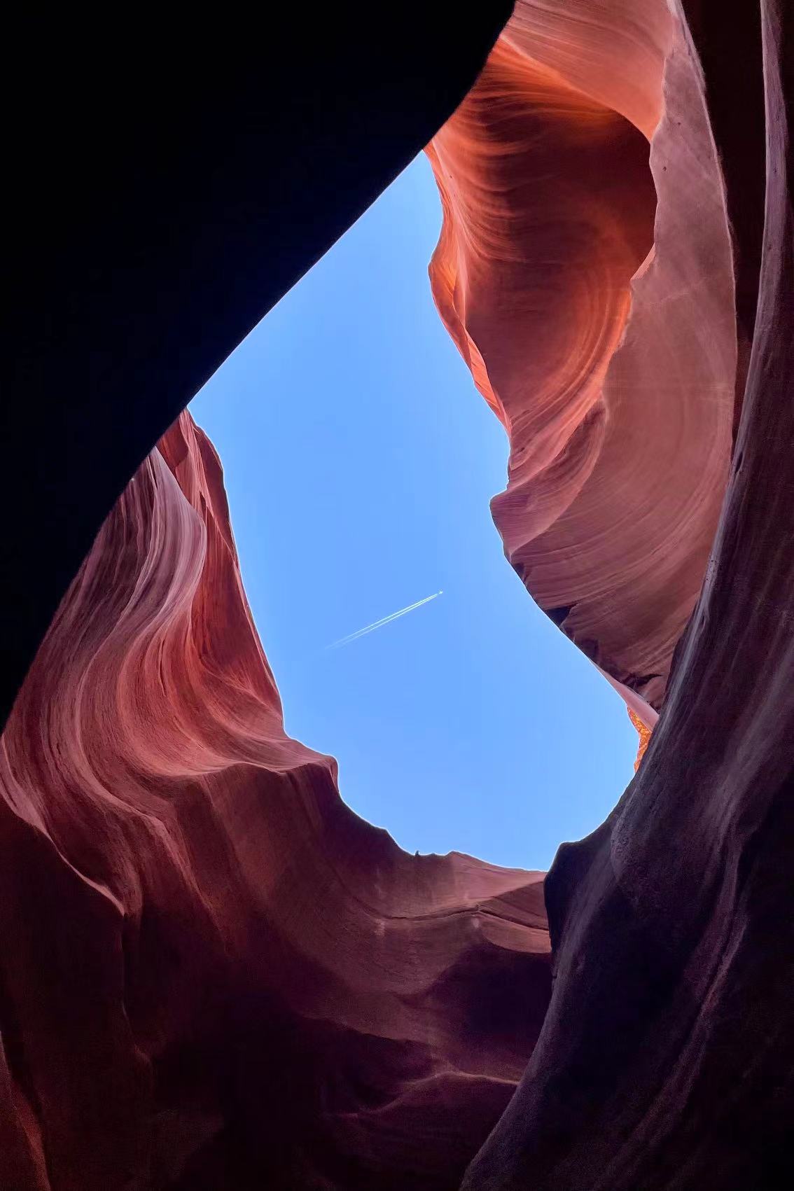
Antelope Canyon. /Courtesy of Wan Hailun
Only seven miles away from the Antelope Canyon lies the Horseshoe Bend in Glen Canyon National Recreation Area. The Colorado River makes a wide sweep here, creating a roughly 305 meters deep, 270º horseshoe-shaped bend.
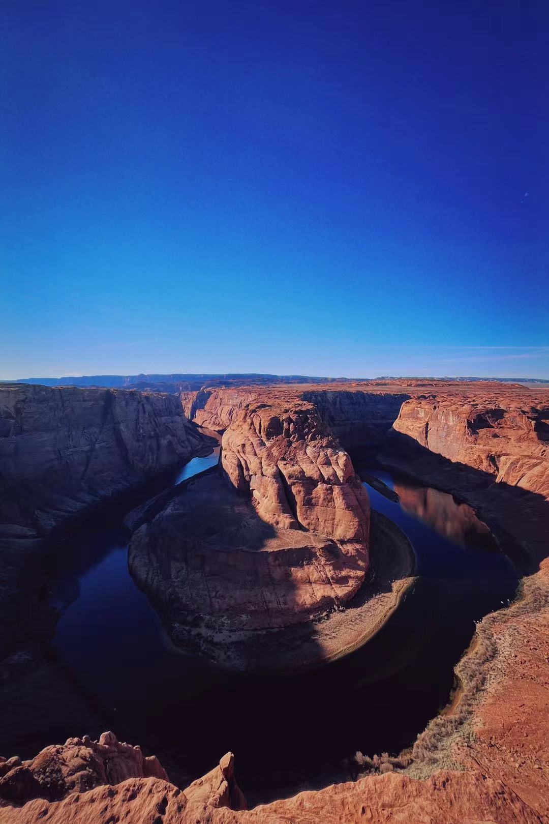
Horseshoe Bend. /Courtesy of Wan Hailun
For more from the contributor:
National Parks Tour: Grand Canyon National Park
(All photos taken by Wan Hailun.)
(If you want to contribute and have specific expertise, please contact us at nature@cgtn.com.)