- Home
- China
- World
- Asia-Pacific
- Americas
- Europe
- Middle-East and Africa
- Politics
- Business
- Opinions
- Tech & Sci
- Culture
- Sports
- Travel
- Nature
- Picture
- Video
- Live
- TV
- Radio
- Specials
- Learn Chinese

Share

Copied
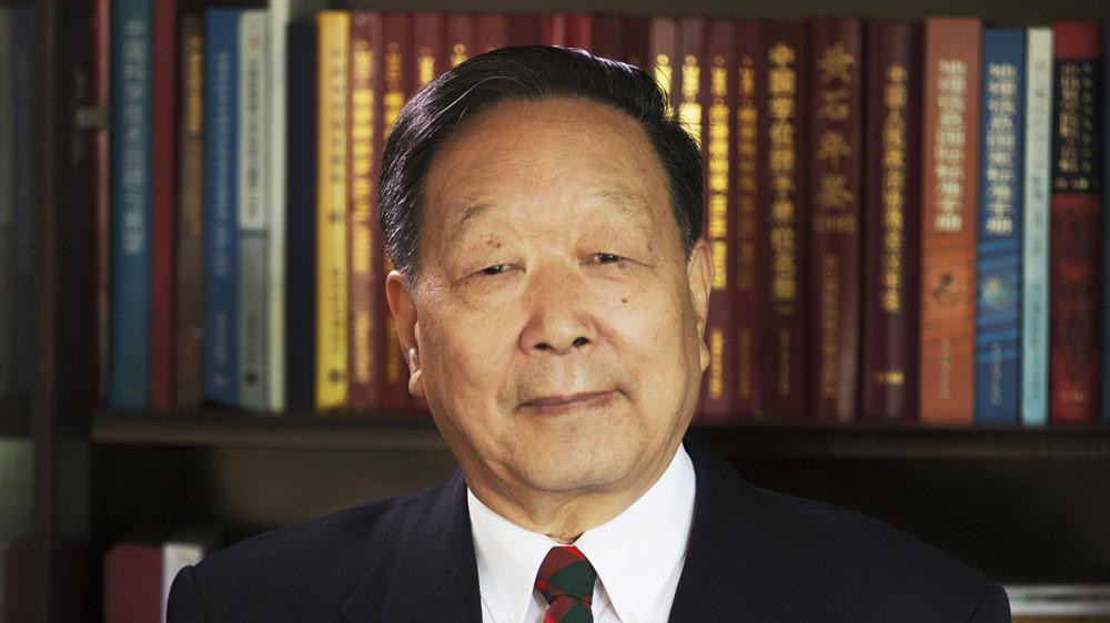
File photo of Professor Li Deren, winner of the 2020 Brock Gold Medal Award. /Wuhan University
Chinese scientist Li Deren from central China's Wuhan University has won the 2020 Brock Gold Medal Award, one of the most influential awards in the field of international photogrammetry and remote sensing.
Li, 83, is the first Chinese scholar to win the award, which was set up by the American Society for Photogrammetry and Remote Sensing in 1952. It's conferred to only one scientist every four years for his/her outstanding contributions to the field.
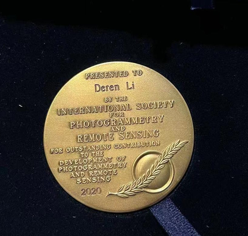
The 2020 Brock Gold Medal presented to Li Deren. /Wuhan University
Including Li, only 16 scholars worldwide have received the award so far.
Li was remotely presented with the award via video link during the International Society for Photogrammetry and Remote Sensing (ISPRS) Congress 2022 in France on June 6.
"This honor belongs not only to me, but also to my team, my university and my country. In the future, we will continue to use photogrammetry and remote sensing technology to provide human society with faster, more accurate, more reliable and better intelligent spatial information service," he was quoted as saying in a video message by Science and Technology Daily.
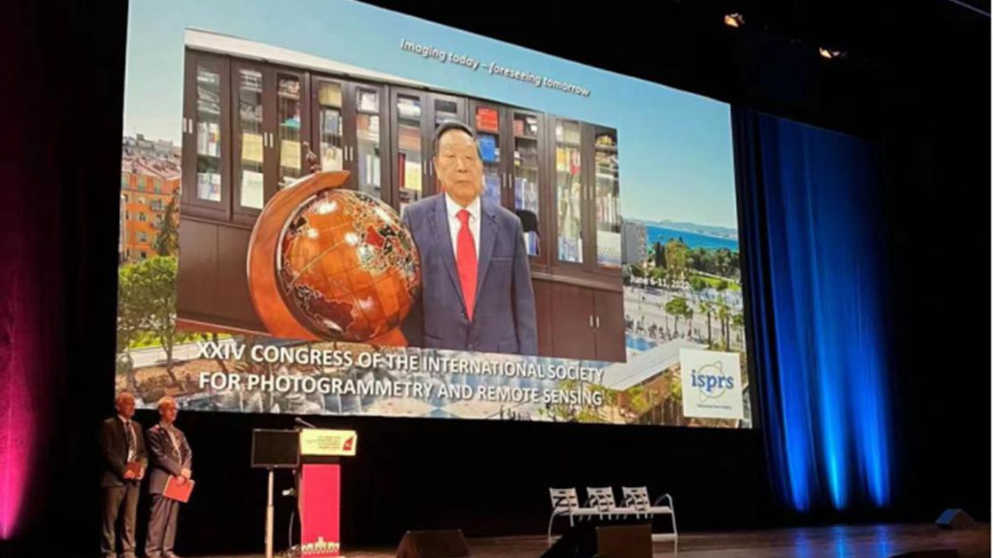
Li Deren is remotely presented with the award during the International Society for Photogrammetry and Remote Sensing (ISPRS) Congress 2022 in France, June 6, 2022. /Wuhan University
Li, director of the Geospatial Information Technology Collaborative Innovation Center at Wuhan University, enjoys dual membership of both the Chinese Academy of Sciences and the Chinese Academy of Engineering, the country's top two research institutes.
His major achievements include the design of ZY-3, China's first civilian high resolution mapping satellite used to produce 1:50,000 orthophotos, the ISPRS wrote.
Collaborating with his colleague Gong Jianya, he further developed three generations of Geographic Information System software GeoStar, GeoGlobe and GeoSmart, which have been widely used for the construction of digital cities and smart cities in China and beyond, according to the ISPRS.
He was also instrumental in introducing the integration of theories and algorithms for global navigation satellite systems, remote sensing and geographic information systems, which support such diverse applications as mobile mapping and many others.