- Home
- China
- World
- Asia-Pacific
- Americas
- Europe
- Middle-East and Africa
- Politics
- Business
- Opinions
- Tech & Sci
- Culture
- Sports
- Travel
- Nature
- Picture
- Video
- Live
- TV
- Documentary
- Radio
- Specials
- Learn Chinese

Share

Copied
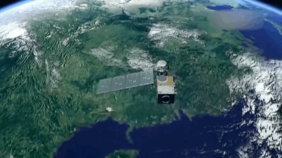
Animation of a FengYun meteorological satellite scanning the Earth. /China Media Group
China's FengYun weather satellites (or FY) have been closely monitoring key data as the country's been hit by the intense heat wave.
The global heat wave has impacted the country starting from June 13 and lasted for more than two months, swiping from southwestern Sichuan Province to coastal Jiangsu. In some areas, temperatures have exceeded 40-degrees Celsius.
"This year's heat wave has the characteristic of long duration, high intensity and hits wide range or area," said Fan Yingting, general chief designer of the FengYun-4 satellites.
China started launching FengYun meteorological satellite series since the 1970s and has deployed 19 in orbit with seven of them operational, including FY-2G, FY-3C, FY-3D, FY-4A, and FY-4B that have played an important role for meteorologists to look at regional temperature history and spectrum during the current heat wave, according to Fan.
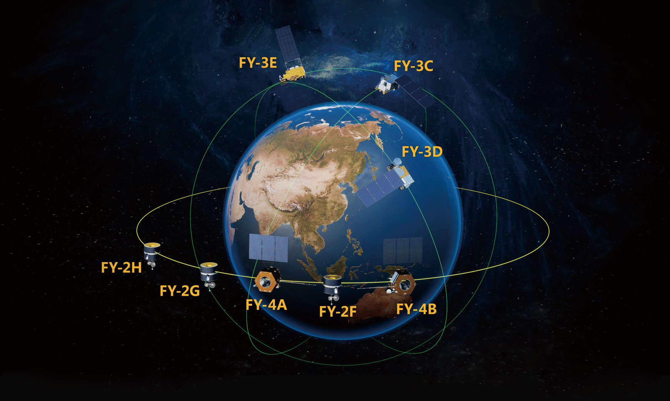
China's FengYun series satellites in orbit as of 2021. /National Satellite Meteorological Center
Weather satellites can be either polar orbiting that are placed in the sun-synchronous orbits (SSO) and can cover the entire Earth asynchronously, or geostationary, which hover over the same spot above the equator at altitudes of 35,880 km.
While the FY-2 and FY-4 are geostationary, the polar-orbiting FY-3 series offer a much better resolution than their geostationary counterparts as they are closer to Earth and can survey a location twice a day. Together the combo provide ample of information for weather forecast and disaster prevention, according to Fan.
Key data for climate change
While primarily used to detect the development and movement of storm systems and other cloud patterns, meteorological satellites are also used for monitoring key data for climate change with modules carried on satellites.
For example, the FengYun series satellites are equipped with microwave thermometer, moisture meter and microwave imager. In addition, some more advanced equipment such as the vertical atmospheric sounding and microwave detector and interferometric vertical detector are also installed aboard latest generation of FengYun satellites.
"Through mutual coordination, we have mastered a series of atmospheric, oceanic and earth surface data, including data of land and sea surface temperature, atmospheric vertical temperature, and sea ice areas in the two polar zones, as well as satellite cloud images of weather systems," Fan said.
As heatwaves cause other meteorological disasters such as droughts, typhoons, rainstorms and snowstorms, they can result in serious losses.
Environmental data monitored and obtained by FY-3 is used for analyzing the development of regional drought and disaster management through early-warning announcement.
China's FengYun satellites are providing services for users in 121 countries and regions around the world, and three of them have been officially recognized as on-duty satellites of International Charter Space and Major Disasters (CHARTER).
Collectively, weather satellites flown by the U.S., Europe, India, China, Russia and Japan provide nearly continuous observations for a global weather watch.
Search Trends
Copyright © 2020 CGTN. 京ICP备16065310号

Disinformation report hotline: 010-85061466
Copyright © 2020 CGTN. 京ICP备16065310号
Disinformation report hotline: 010-85061466
Copyright © 2020 CGTN. 京ICP备16065310号
Disinformation report hotline: 010-85061466