Share

Copied
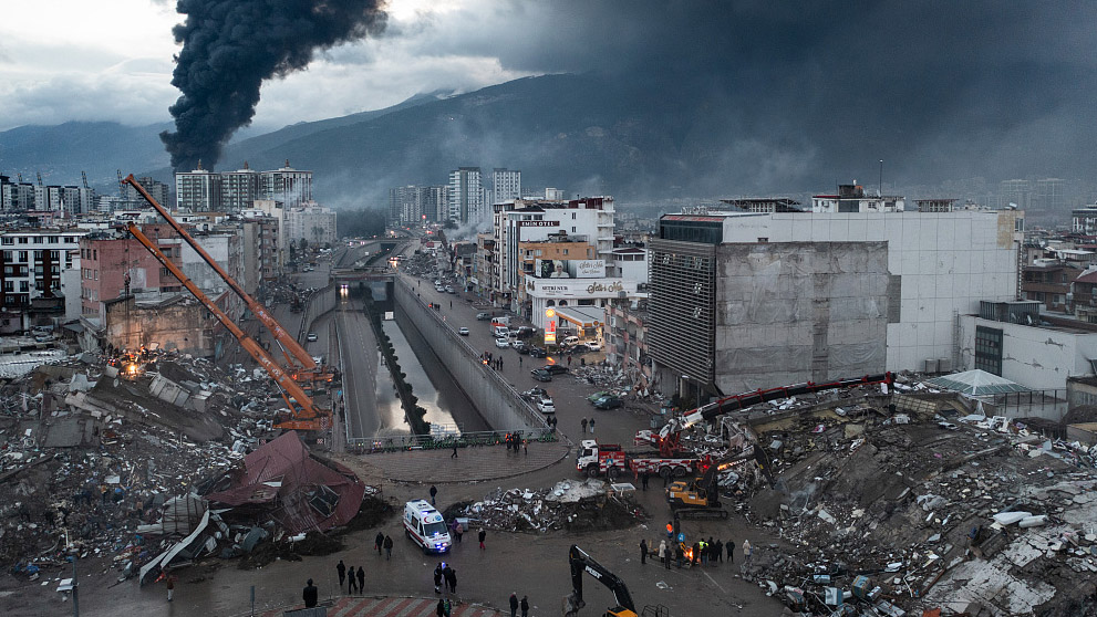
The earthquake that struck southeastern Türkiye on Monday is believed to be the strongest since 1939 when an earthquake of the same magnitude of 7.8 struck the eastern part of the country. Even rarer, this time, a second tremor occurred less than 10 hours after the first, 7.5 in magnitude according to the U.S. Geological Survey (USGS) and 7.8 according to the China Earthquake Networks Center (CENC).
Sitting on the hotbed of Alpine-Himalayan orogenic belt, or Alpide belt, which is known as the second most seismically active region in the world, Türkiye has experienced many earthquakes.
The epicenter and affected areas this time lie at the intersection of three tectonic plates, the Arabian, the Anatolian and the African plates. As these plates push against each other, a 7.8-earthquake is "generally expected on long, plate-boundary strike-slip faults," according to the USGS.
Some believe that the event is related to increasing activity along the seismic belt, however, Ji Jianqing, a professor at the School of Earth and Space Sciences at Peking University, said it's because "the energy accumulated from plates' movement has reached the threshold for a strong earthquake, and the energy release is a result of long-time accumulation. There's no evidence showing that the Meizoseismal area (an earthquake in the area of maximum damage) has entered an active period."
As the earthquake occurred at night when people were sleeping, the destruction is more severe and the death toll is still increasing. Beyond the frequent and strong aftershocks, professor Ji pointed out the first M7.8 quake lasted 4 minutes, which is very special. He indicated that the destructive energy of the earthquake could be underestimated by just looking at its magnitude.
Earthquake has caused worse destruction along the fault zones. According to professor Ji, Türkiye is nearly blanketed by NE-SW faults that are related to seismic activity, and many of the faults are boundaries between valleys, basins and mountains. These fault zones have absorbed a large number of energy from the seismic waves, which brought relatively concentrated damages to the area that the fault zone passes through. Secondary disasters from an earthquake, such as landslides and falling rocks also pose threats to humans and houses.
(Cover image via CFP)
(If you want to contribute and have specific expertise, please contact us at nature@cgtn.com.)
Search Trends
SITEMAP
Copyright © 2023 CGTN. 京ICP备16065310号

Disinformation report hotline: 010-85061466
SITEMAP
Copyright © 2023 CGTN. 京ICP备16065310号
Disinformation report hotline: 010-85061466