Share

Copied
China's space authority released the first batch of images taken by the hyperspectral comprehensive observation satellite in Beijing on Tuesday, showing 14 images that can best reflect the unique functions of the satellite.
The images showed the concentration of ozone and nitrogen dioxide across the globe, as well as temperature and sea ice in specific areas.
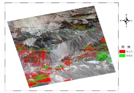
An image taken by the hyperspectral comprehensive observation satellite showing a mineral reserve. /CNSA
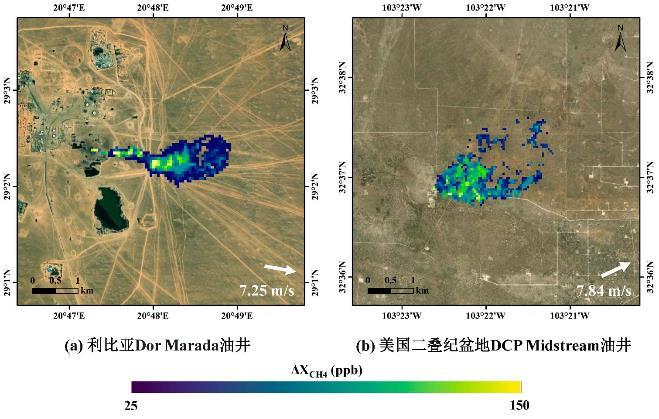
An image taken by the hyperspectral comprehensive observation satellite showing oil fields in Libya and U.S. /China National Space Administration (CNSA)
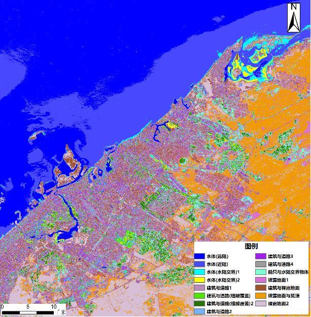
An image taken by the hyperspectral comprehensive observation satellite showing different kinds of ground objects. /CNSA
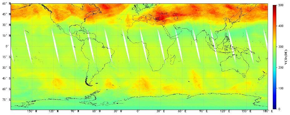
An image taken by the hyperspectral comprehensive observation satellite showing ozone concentration across the globe. /CNSA
The image data can be used for greenhouse gas detection, remote sensing of inland water quality, fine classification of land objects and mineral resource investigation.
The hyperspectral comprehensive observation satellite operates in a sun-synchronous and quasi-polar orbit at an altitude of 705 kilometers.
Equipped with cameras, spectrometers and imagers, the satellite was launched on December 9, 2022.
Testing of the satellite was completed on January 21, 2023. So far, the ground system has received 320 terabytes of data and produced 12,256 scenes of top-level images.
In addition, the data from this satellite will be shared on the China Platform of Earth Observation System (CPEOS), which has an international version.
The platform will keep providing remote sensing data and services for civil purposes, and promoting the construction, sharing, and utilization of China's remote sensing data.
(Cover: China launches a remote sensing satellite from the Taiyuan Satellite Launch Center, December 9, 2022. /China Media Group)
Search Trends
SITEMAP
Copyright © 2023 CGTN. 京ICP备16065310号

Disinformation report hotline: 010-85061466
SITEMAP
Copyright © 2023 CGTN. 京ICP备16065310号
Disinformation report hotline: 010-85061466