Share

Copied
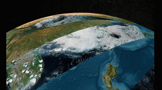
A multi-view display of the 3D structure in the rainfall zone by FY-3G satellite. /National Satellite Meteorological Center
China on Monday released the first set of images from Fengyun-3G (FY-3G), the country's first precipitation measurement satellite in a low-inclination orbit, helpful to better monitor and forecast severe precipitation systems.
The monitoring images were captured by six payloads aboard the FY-3G satellite. They show the three-dimensional (3D) structure of precipitation at different levels.
These satellite-borne payloads include four operational payloads, namely precipitation measurement radar, microwave imager, medium-resolution spectral imager, and the second-generation global navigation satellite system occultation sounder (GNOS-II), as well as two test ones – near-infrared multi-angle polarization imager and high-precision calibrator.
The precipitation measurement radar, the main payload, is the first of its kind in China.
Adopting Ku/Ka-band dual-frequency, the measurement radar, mainly used for precipitation monitoring in catastrophic weather systems, can clearly observe the internal 3D structure of typhoon, rainstorm, blizzard and other precipitation systems.
The satellite captured the 3D structure of the precipitation system in a severe convective weather system that appeared in south China on May 7, for which the National Meteorological Center issued blue alerts for rainstorm and for severe convective weather.
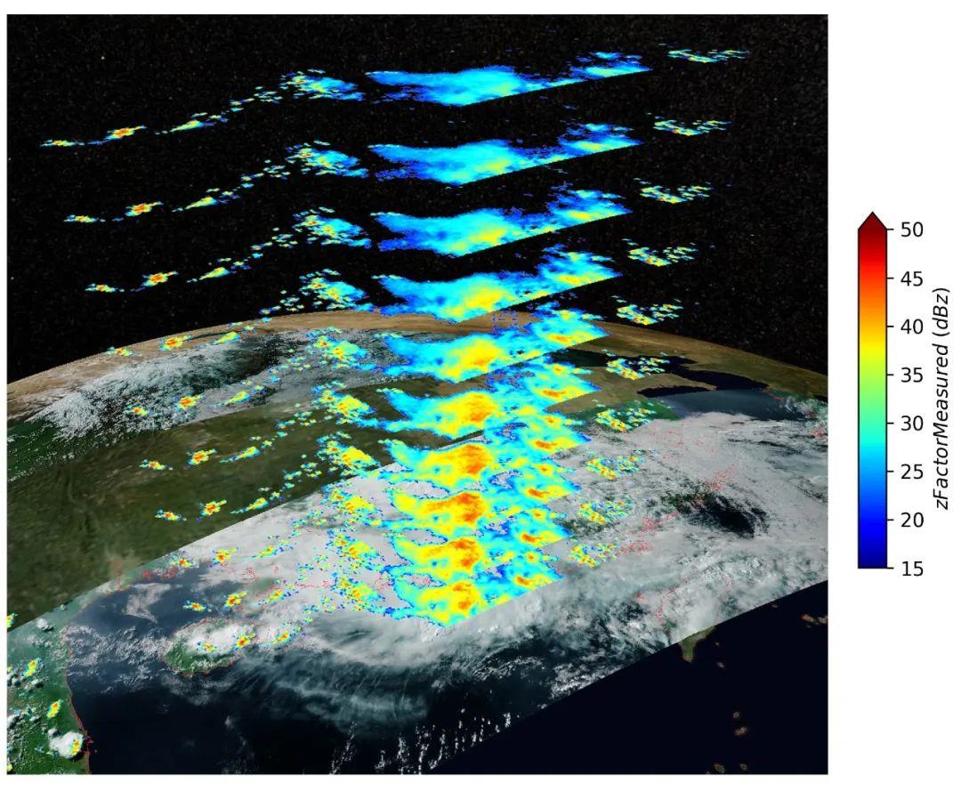
The 3D structure of the precipitation system from 3.75 km to 6 km from the surface in the rainfall near south China's Hainan Province and Yangjiang in Guangdong Province captured by FY-3G's precipitation measurement radar, May 7, 2023. /National Satellite Meteorological Center
With a lifespan of six years, the FY-3G satellite has been developed by the Eighth Research Institute of China Aerospace Science and Technology Corporation, and its ground system will be built and operated by the China Meteorological Administration (CMA).
It was launched from the Jiuquan Satellite Launch Center in northwest China on April 16, marking the third precipitation measurement satellite in the world capable of proactive measurement, and making China the only country in the world that operates meteorological satellites in four near-earth orbits, said CMA.
The satellite will "ramp up monitoring and forecasting of cloud and precipitation under the severe weather system, and meteorological disaster prevention , reduction and relief capacities against the backdrop of global climate change," said CMA.
Read more: China's first satellite offering high-precision rainfall monitoring launched
Search Trends
SITEMAP
Copyright © 2023 CGTN. 京ICP备16065310号

Disinformation report hotline: 010-85061466
SITEMAP
Copyright © 2023 CGTN. 京ICP备16065310号
Disinformation report hotline: 010-85061466