Share

Copied
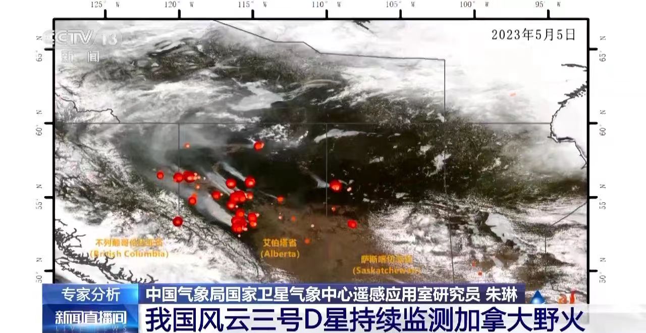
Satellite image captured by China's weather satellite Fengyun-3D shows Canadian wildfires, May 5, 2023. /CMG
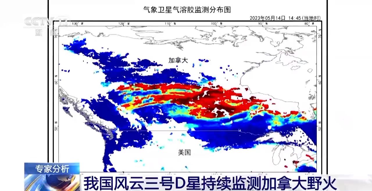
Distribution map of aerosol optical depth over Canada and the U.S., May 14, 2023. /CMG
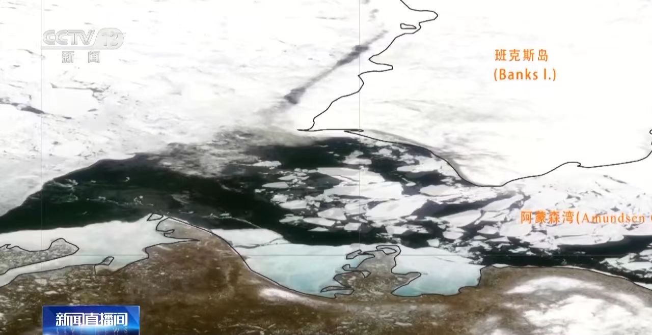
Satellite footage shows the Arctic sea ice in the Amundsen Bay, northern Canada, was melted. /CMG
The rare, destructive wildfires from Canada are ongoing, resulting in smoke moving into parts of the United States and bad air quality.
The forest fires, which started due to record heat and drought, haven't been controlled, said Zhu Lin, a researcher at the National Satellite Meteorological Center under the China Meteorological Administration.
The researcher added that there was still thick smoke in the sky and it will impact more on the central and eastern U.S..
These remarks were verified by the Canadian Interagency Forest Fire Center (CIFFC). According to the latest map updated by the center, there are currently 422 active fires, of which 52.1 percent are out of control, over 21 percent are labeled "being held" and only 26.5 percent are under control.
A fire "being held" means it is not moving but is still not under control.
According to Zhu, satellite footage from mid-to-late May showed that the wildfires in western and central Canada have intensified. The fire intensity is very high in Alberta, Saskatchewan, British Columbia and most of the Northwest Territories.
Smoke from western Canada spread southeast in early June, and there are some new fires in the eastern Canadian province of Quebec, said Zhu.
Smoke continues to drift east, said the researcher, adding that if these blazes aren't contained, more smoke may affect Canada and eastern-central U.S.
Arctic sea ice in the Amundsen Bay, northern Canada, has melted earlier than last year, said Zhu. "This is due to continued temperature increases and interactions between particulate matter and cloud caused by blazes."
The Fengyun-3D satellite
Launched on November 15, 2017, the Fengyun-3D meteorological satellite was designed to obtain meteorological parameters to improve weather forecast accuracy, monitor greenhouse gas, ozone, natural disasters and environment changes.
Read more: China launches new weather satellite Fengyun-3D to provide better free data
The satellite is the fourth Fengyun satellite series. Combined with the newly launched Fengyun-3G satellite, China now has eight Fengyun meteorological satellites in orbit, providing data and services to 126 countries and regions.
Read more: Canada wildfires continue as smoke shrouds large parts of U.S.
Search Trends
SITEMAP
Copyright © 2023 CGTN. 京ICP备16065310号

Disinformation report hotline: 010-85061466
SITEMAP
Copyright © 2023 CGTN. 京ICP备16065310号
Disinformation report hotline: 010-85061466