Share

Copied
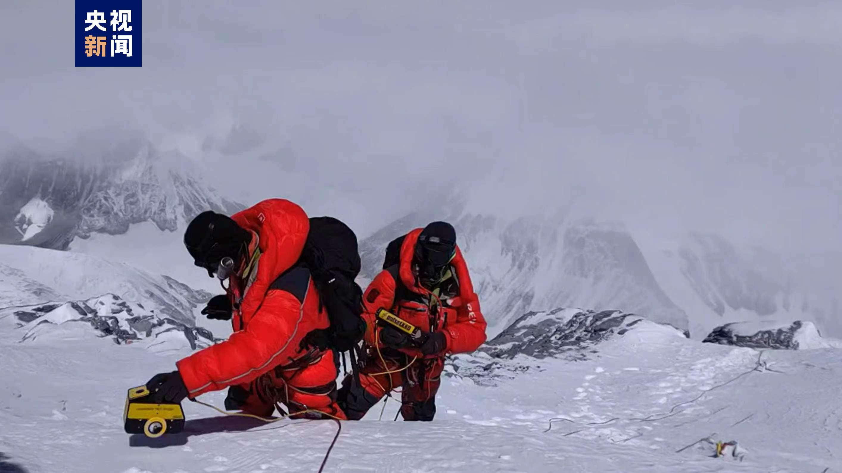
A Chinese expedition team measures the snow thickness on Mount Qomolangma, May 4, 2022. /China Media Group
A Chinese expedition team has employed a precise ground-penetrating radar to measure the thickness of snow on Mount Qomolangma, revealing that the mean depth estimates at the summit are 9.5±1.2 meters, according to a newly-published paper in the journal The Cryosphere.
The data was collected in May 2022 during a Mount Qomolangma expedition that was part of China's second comprehensive scientific exploration of the Qinghai-Xizang Plateau.
Among the objectives of this scientific endeavor was the investigation of snow depth on Mount Qomolangma.
Using radar profile measurement methods, the expedition team utilized a 1,000 megahertz thickness-measuring radar to gauge the snow depth from the exposed bedrock at the peak of Mount Qomolangma and progressively toward the summit.
Yang Wei, a researcher from the Institute of Tibetan Plateau Research under the Chinese Academy of Sciences, explained that the radar measurements revealed a gradual increase in snow depth along the north slope, facilitating the precise interpretation of the data.
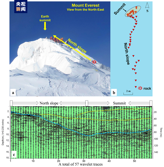
A diagram showing the measurement location (top) and radar image. /CMG
Yang said the propagation speed of radar waves in the snow is between 0.20-0.27 nanometers per second (nm/s). In 2005, the Chinese Mountaineering Expedition measured the radar propagation velocity in the snow at 7,028 meters to be 0.23 nm/s.
During China's second comprehensive scientific expedition on the Qinghai-Xizang Plateau last year, the expedition team adopted the same propagation velocity and concluded the average thickness of the summit to be 9.5 meters.
"However, considering that the nature of the snow cover on the summit may be different from that at 7,028 meters, we have given an error range (±0.03 nm/s) for the transmission speed of radar waves, thus giving a possible error of ±1.2 meters," Yang explained.
Yao Tandong, the team leader of the second scientific expedition, said the survey results will contribute to the study of dynamic changes in the ultra-high altitude cryosphere and lithosphere at the summit of Mount Qomolangma.
These findings, which were published in the journal The Cryosphere, offer new insights for a deeper understanding of climate changes in ultra-high altitude regions.
(With input from Xinhua)
Search Trends
SITEMAP
Copyright © 2023 CGTN. 京ICP备16065310号

Disinformation report hotline: 010-85061466
SITEMAP
Copyright © 2023 CGTN. 京ICP备16065310号
Disinformation report hotline: 010-85061466