Share

Copied
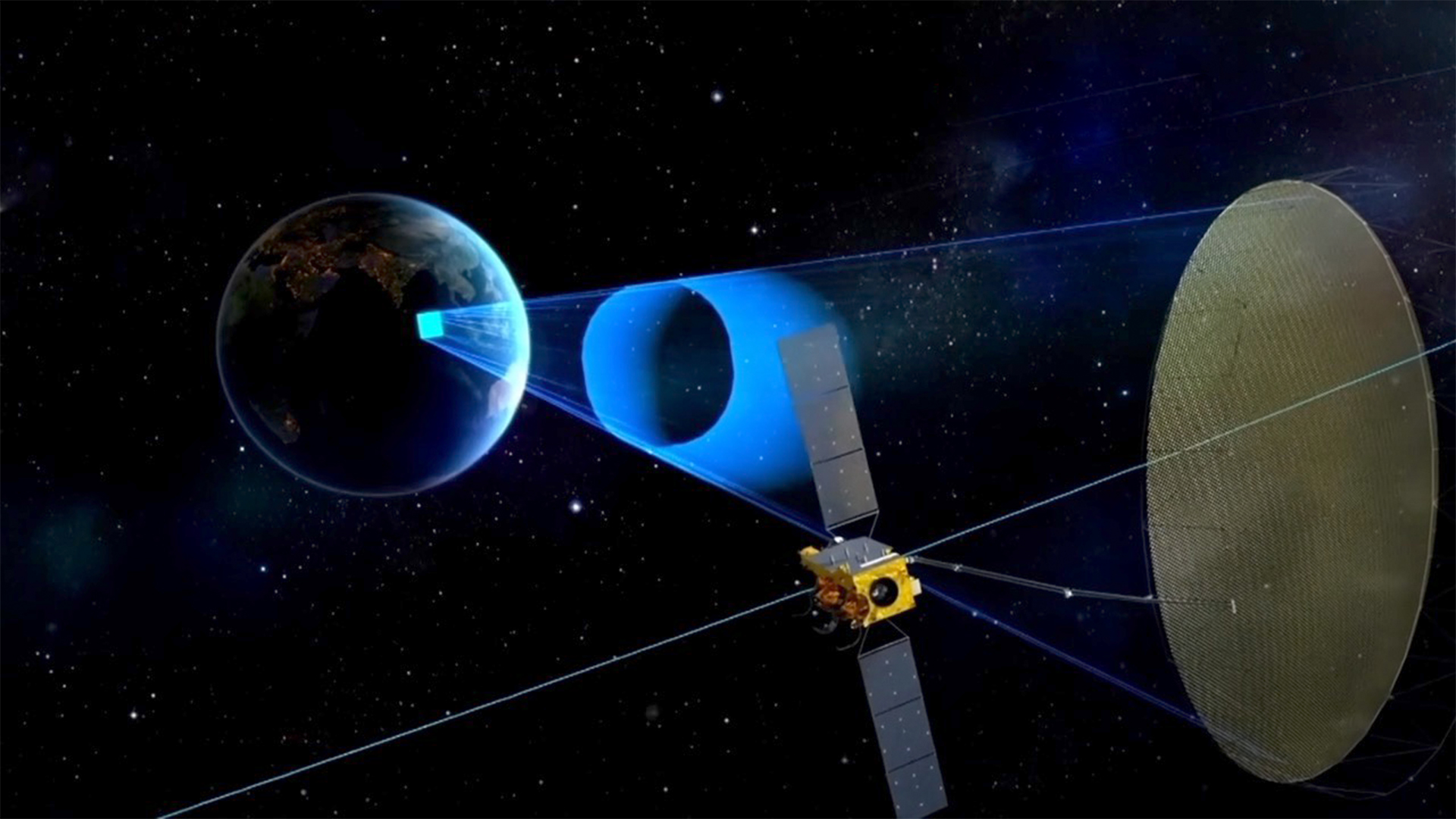
China's L-SAR4 01 satellite, the world's first high-orbit synthetic aperture radar (SAR) satellite, has entered its operational orbit, the China National Space Administration (CNSA) said on Monday.
The satellite is now in sound condition, with the SAR antenna successfully deployed, and will carry out in-orbit testing in the follow-up tasks, said the CNSA.
The satellite precisely entered the preset orbit after four orbital maneuvers, said Meng Lingjie, deputy chief designer of engineering at CNSA's Earth Observation System and Data Center.
Meng said unfurling the large circular SAR antenna is "very critical," as only after that can the meticulous in-orbit testing be carried out, and the satellite will be put into service after fully completing the in-orbit testing.
Launched on August 13 by a Long March-3B rocket, the satellite has broken through key technologies and is able to provide all-day, all-weather observation of China's territory and surrounding areas.
"It provides direct and time-sensitive SAR data for the country's disaster prevention and reduction, which will improve the comprehensive abilities in disaster prevention, mitigation and relief," said Meng.
The satellite can also meet the needs of earthquake monitoring, land and resource surveying, and be applied in industries such as marine, water conservancy, meteorology, agriculture, environmental protection and forestry.
Taking pictures without light
Compared to optical remote sensing satellites that use cameras for observation, the L-SAR4 01 satellite is equipped with synthetic aperture radar, which emits electromagnetic waves to the Earth and then receives the reflected-back waves for analysis to obtain information-abound radar images.
The satellite, thus, can obtain images without light and observe beneath the clouds, providing all-day, all-weather Earth observation, which is of great significance for application scenarios such as disaster prevention and mitigation.
It can facilitate getting information in time about the stricken areas in cases of extreme weather disasters when optical means fail to obtain images, for example, whether bridges and roads have collapsed and how much water has spread, said Zhang Qingjun, researcher for the general development of remote sensing satellites at the China Academy of Space Technology.
Flying higher, seeing farther
The L-SAR4 01 satellite is running in a particularly high orbit – nearly 40,000 kilometers from the Earth.
Generally, satellites operating in low orbits of 500 or 700 kilometers stay for about 10 minutes in a certain area, and the revisit for the same area would take place several days later, which is not time-efficient.
Compared with such satellites, the L-SAR4 01 satellite has the advantages of a short observation revisit period and a large imaging width, which can be complementary with the low-orbit satellites.
"The satellite has a broad view, but with a lower resolution than that of low-orbit satellites," said Zhang.
"We can first get a macro, overall impression of the target area from the large-scale observation and then narrow down to some certain regions with low-orbit satellites for high-resolution, small-scale observation," Zhang added.
Search Trends
SITEMAP
Copyright © 2023 CGTN. 京ICP备16065310号

Disinformation report hotline: 010-85061466
SITEMAP
Copyright © 2023 CGTN. 京ICP备16065310号
Disinformation report hotline: 010-85061466