Share

Copied
At the Jiangxi Nanfengmian National Nature Reserve, east China's Jiangxi Province, researchers are busy banding birds during their migration period from September to October.
Bird banding, which involves attaching customized tags to birds' legs or wings, is one of the oldest techniques to track the movements and life history of birds.
This year, the reserve staff are applying China's BeiDou Navigation Satellite System (BDS) technology to bird banding.
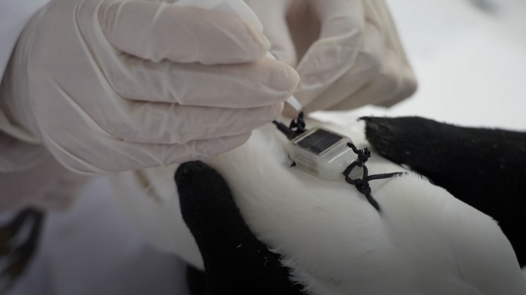
Some of the birds have been equipped with specially-designed positioning devices, which are small and light enough to not affect flight or rest.
"This is a 6.5-gram backpack-type tracker, and it does not exceed 3 percent of this little egret's body weight," said Wang Chaoyang, a postgraduate student at the School of Life Sciences of Jiangxi Normal University.
These devices will continuously send various data to back-end servers, enabling researchers to analyze migration routes, stopping places and migration time, according to a nature reserve official.
"We are using this satellite tracker to understand the migration route more accurately and in a timely manner. For example, where does it come from, when does it come, what is its flying speed and what is its flying altitude, we can get all these information precisely," said Zhu Gaodong, a senior engineer of the Jiangxi Nanfengmian National Nature Reserve Administration.
So far, 614 birds have been labeled and 36 of them have been equipped with BeiDou trackers.
(If you have specific expertise and want to contribute, or if you have a topic of interest that you'd like to share with us, please email us at nature@cgtn.com.)
Search Trends
SITEMAP
Copyright © 2023 CGTN. 京ICP备16065310号

Disinformation report hotline: 010-85061466
SITEMAP
Copyright © 2023 CGTN. 京ICP备16065310号
Disinformation report hotline: 010-85061466