Share

Copied
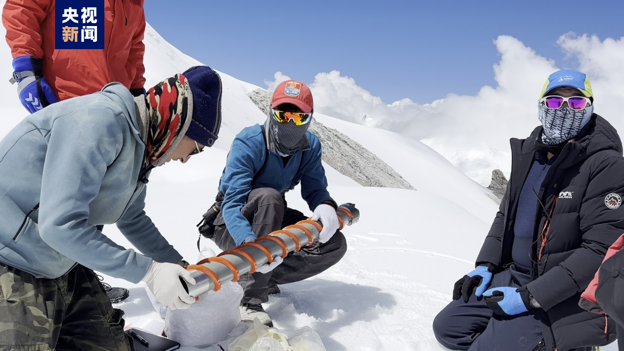
Members of a Chinese expedition team practice for drilling of ice cores at an altitude of 6,450 meters in the Mount Cho Oyu region on the China-Nepal border, September 30, 2023. /CMG
Snow and ice samples were collected on Mount Cho Oyu, the world's sixth-highest peak, for the first time, in a bid to unveil more about the environmental changes in this exceptionally high-altitude region, the Chinese expedition team said Monday.
The day before, an 18-member expedition team successfully reached the summit of Mount Cho Oyu, also known as Mt. Qowowuyag, which soars to 8,201 meters above sea level, to carry out scientific research.
It was the first time that Chinese scientists had scaled a peak exceeding 8,000 meters in altitude apart from Mt. Qomolangma, the world's highest summit.
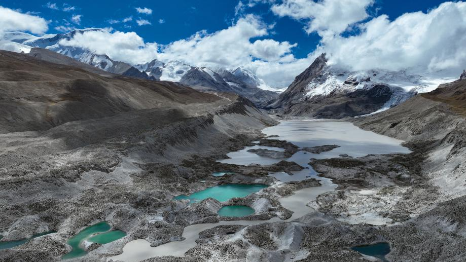
This aerial photo shows a proglacial lake in the Mount Cho Oyu region on the China-Nepal border, September 29, 2023. /Xinhua
The summit of Mt. Cho Oyu is particularly wide and broad similar to a football field, which is very rare among the highest peaks in the world.
Preliminary research revealed that the peak ice layer thickness is the thickest among the peaks above 8,000 meters, with a visual thickness of over 70 meters, according to Yao Tandong, an academician with the Chinese Academy of Sciences (CAS).
"Compared with the small radar (less than half a meter in length) used during the Mt. Qomolangma expedition, a larger radar (over one meter in length) was used this time in order to better detect snow and ice on the summit," said Yang Wei, a researcher from the Institute of Tibetan Plateau Research, CAS.
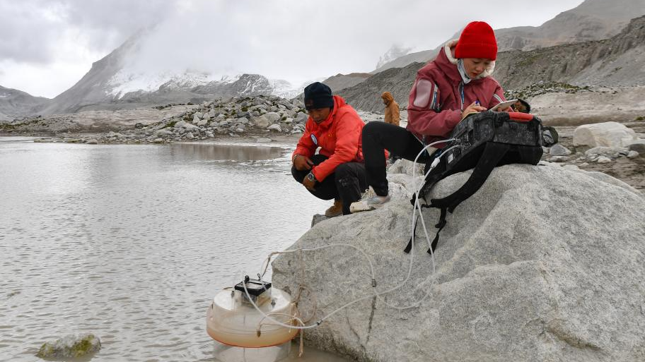
Members of a Chinese expedition team perform a real-time water quality check at a proglacial lake in the Mount Cho Oyu region on the China-Nepal border, October 1, 2023. /Xinhua
Collection of snow and ice samples commenced on September 22 at altitudes of 6,450 meters and higher.
The samples will be used for analysis of stable isotopes, black carbon, aerosols, etc., to study environmental changes at Mt. Cho Oyu, said Xu Baiqing from the Institute of Tibetan Plateau Research, CAS, leader of the ice core drilling team, adding that cylindrical ice cores drilled would first be buried on site and only transported to the freezer at the base camp at 5,700 meters once the temperature dropped in the evening.
"Mt. Cho Oyu is close to Mt. Qomolangma and is strongly influenced by the Indian monsoon. By obtaining snow and ice samples from different altitudes, we can trace back the environmental changes in different historical periods and altitudes," Xu said.
"The samples are like a book without words, which can directly reflect the impact of climate on the melting process of glaciers in the context of global warming."
The samples can reveal the change process and mechanism of Asia's "water tower" cryosphere, which will provide scientific support for the ecological protection of the Qinghai-Xizang Plateau, Yao added.
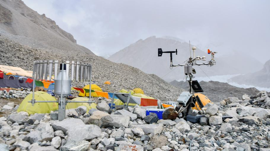
An automatic meteorological station set up at the altitude of 5,700 meters in the Mount Cho Oyu region on the China-Nepal border, September 29, 2023. /Xinhua
Meteorological observation stations
Five automatic weather stations have also been set up at altitudes of 4,950, 5,700, 6,450, 7,100 and 8,201 meters, respectively, on Mt. Cho Oyu for the first time, while precipitation observation equipment was installed at the two lower stations.
The summit of Mt. Cho Oyu is particularly wide and broad similar to a football field which makes it easy to set up and repair a weather station.
The establishment of the weather station is aimed at revealing more about the characteristics of climate change in this extremely high-altitude region.
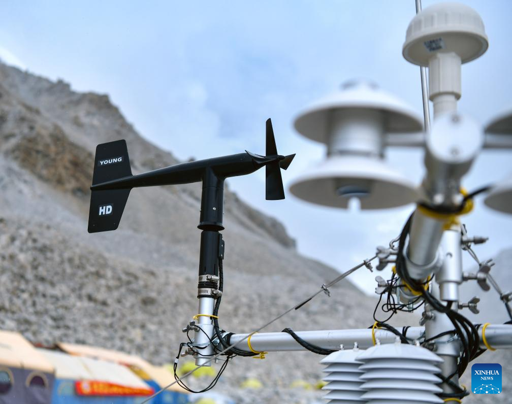
An automatic meteorological station set up at the altitude of 5,700 meters in the Mount Cho Oyu region on the China-Nepal border, September 29, 2023. /Xinhua
Together with the Qomolangma-Shishapangma weather stations already established, this expanded meteorological observation network will help reveal more characteristics of climate change in this extremely high-altitude region, said Zhao Huabiao, a researcher with the Institute of Tibetan Plateau Research under the CAS.
Zhao's team started installing these weather stations on September 20. Each weather station weighs about 50 kg, and they were disassembled and parts assigned to the various team members. Each member carried parts weighing no more than 7 kg when climbing.
Soon after the expedition team set up the summit weather station, meteorological data was successfully transmitted, revealing a summit temperature of minus 18 degrees Celsius and a wind force of 6 degrees, or 10.8-13.8 meters per second at around 11 a.m. on October 1.
The weather stations are powered by solar panels and can run for two years under normal circumstances. Their daily work is to transmit meteorological information such as temperature, humidity, wind direction and speed, and solar radiation through satellite communication and other means.
The data will help fill blanks in terms of meteorological records for extremely high-altitude regions, and is of great significance for monitoring changes in glaciers and snow cover at high altitudes, said Zhao.
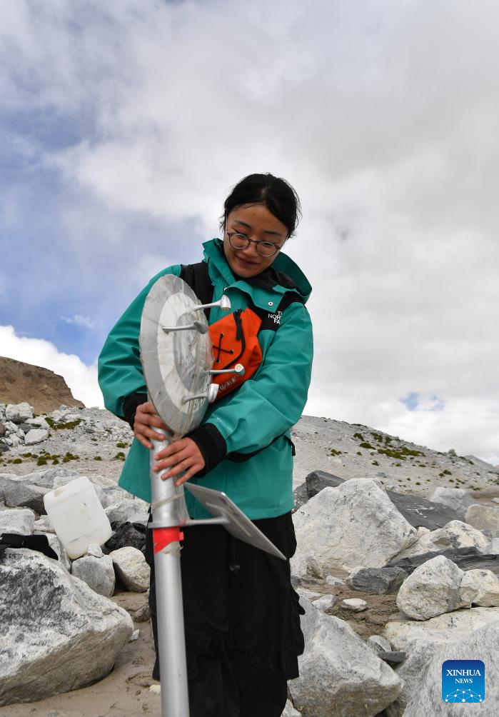
A member of a Chinese expedition team sets up a portable weather station in the Mount Cho Oyu region on the China-Nepal border, October 1, 2023. /Xinhua
The 2023 Mt. Cho Oyu research mission is part of the second comprehensive scientific expedition on the Qinghai-Xizang Plateau initiated in 2017.
Chinese scientists have carried out Mt. Qomolangma expeditions for two consecutive years in 2022 and 2023, setting a number of world records in the process.
Similar to the Mt. Qomolangma missions, the Mt. Cho Oyu expedition is a multi-disciplinary interdisciplinary comprehensive scientific research effort at extremely high altitudes, according to Yao.
Since the end of September, a total of 120 scientists have been conducting research on water, ecology and human activities around the mountain.
(With input from Xinhua)
Search Trends
SITEMAP
Copyright © 2023 CGTN. 京ICP备16065310号

Disinformation report hotline: 010-85061466
SITEMAP
Copyright © 2023 CGTN. 京ICP备16065310号
Disinformation report hotline: 010-85061466