By continuing to browse our site you agree to our use of cookies, revised Privacy Policy and Terms of Use. You can change your cookie settings through your browser.
China's meteorological satellite releases first set of images
Share

Copied
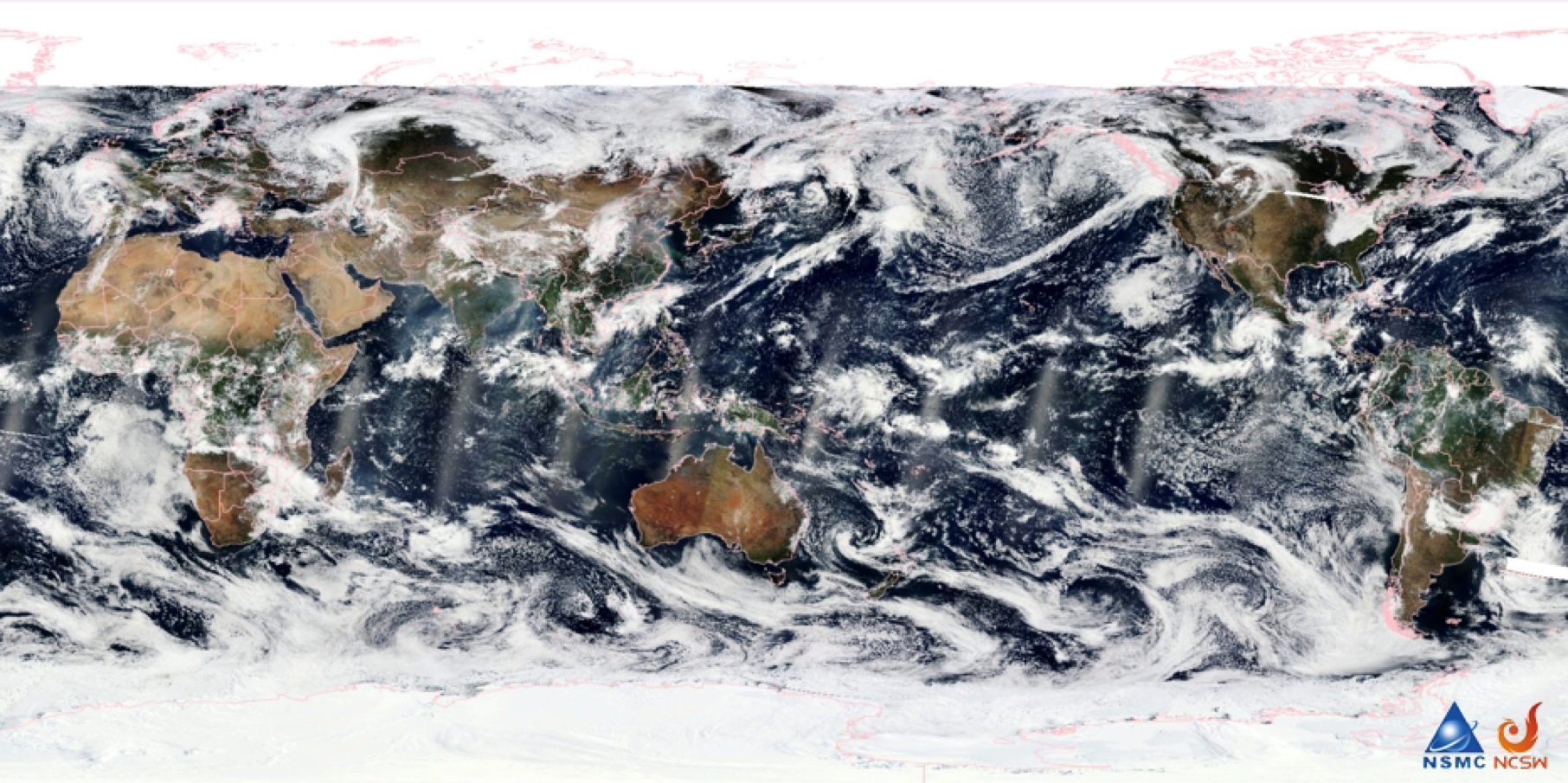
The first global image of medium-resolution spectral imaging of China's meteorological satellite Fengyun-3F. /China Meteorological Administration
The first set of images from China's meteorological satellite Fengyun-3F (FY-3F) was unveiled on Monday.
All remote sensing instruments are operational, according to the Shanghai Academy of Spaceflight Technology, the satellite's developer. These instruments will be used for in-orbit tests in the next phase.
China launched the FY-3F satellite in August, making it the only country in the world to operate four near-Earth orbit civil meteorological satellites simultaneously—covering morning, afternoon, evening and oblique orbits.
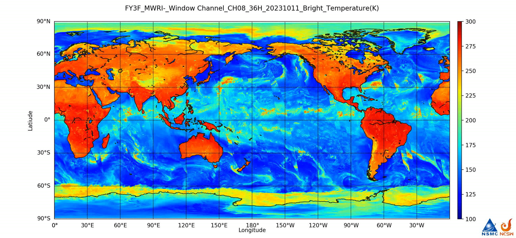
The first image of microwave imaging of Fengyun-3F satellite. /China Meteorological Administration
Thanks to the ten remote sensing instruments on the satellite, it has collected four types of images, including data on the atmosphere's composition, imaging observations, detection data and Earth radiation budget observation data.
The satellite enhances global monitoring of ozone, nitrogen dioxide, sulfur dioxide and other trace gases. Researchers can use a data synthesis tool to generate global clear-sky images based on satellite data. The satellite's microwave imager acquires high-precision, all-day data in all weather conditions, providing crucial support for global environmental monitoring and disaster prevention.
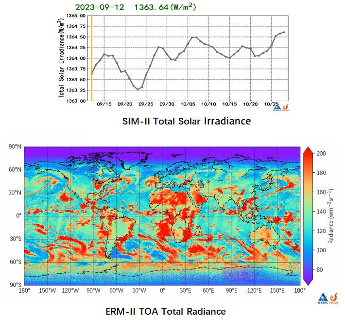
The line chart (above) shows the total solar irradiance and the graph (below) shows Earth's outgoing energy which is the radiation reflected from the Earth's surface. /China Meteorological Administration
Regarding detection data, the satellite has three detectors to conduct CT scans of Earth, obtaining data on atmospheric temperature and humidity, and supporting global weather forecasting.
The FY-3F satellite is expected to commence commercial operation in March next year, serving global meteorological data, according to the Shanghai Academy of Spaceflight Technology.
Search Trends
SITEMAP
Copyright © 2023 CGTN. 京ICP备16065310号

Disinformation report hotline: 010-85061466
SITEMAP
Copyright © 2023 CGTN. 京ICP备16065310号
Disinformation report hotline: 010-85061466