By continuing to browse our site you agree to our use of cookies, revised Privacy Policy and Terms of Use. You can change your cookie settings through your browser.
Jilin-1 satellites unveil stunning high-resolution images of China's Taiwan region
Share

Copied
To mark the 80th anniversary of Taiwan's restoration, China's Jilin-1 satellites have released a series of stunning high-resolution images that clearly capture streets and landmarks from a satellite's perspective.
The collection includes detailed views of Taipei City, the Keelung River and Alishan Mountain.
Developed by Chang Guang Satellite Technology, the Jilin-1 constellation is a key component of China's optical remote sensing network. It currently operates 141 satellites in orbit. According to the developer, the Jilin-1 constellation can revisit global targets up to 40 times per day, allowing near real-time monitoring worldwide. It also offers global coverage six times a year and domestic monitoring about twice a month.
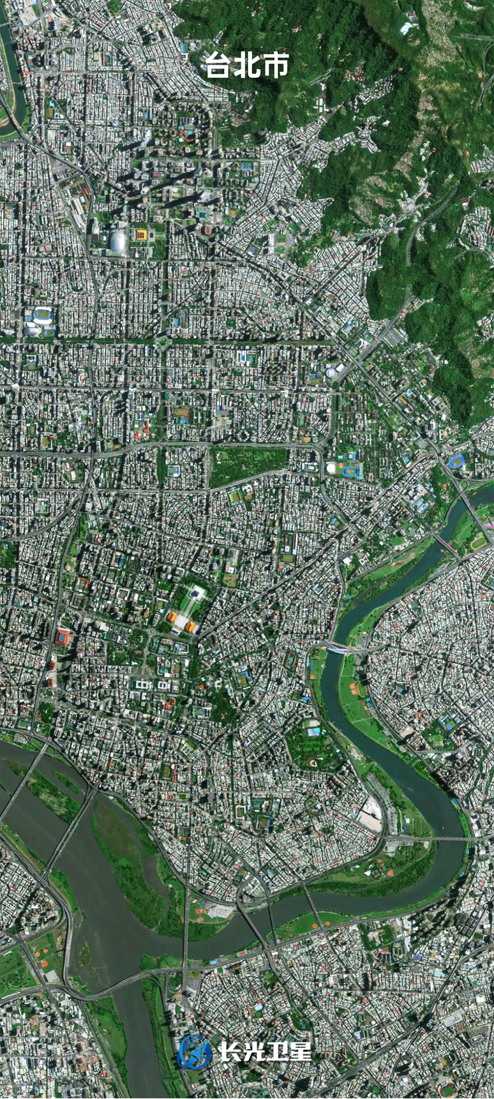
A satellite image of Taipei City in China's Taiwan region, captured by Jilin-1. /Chang Guang Satellite Technology
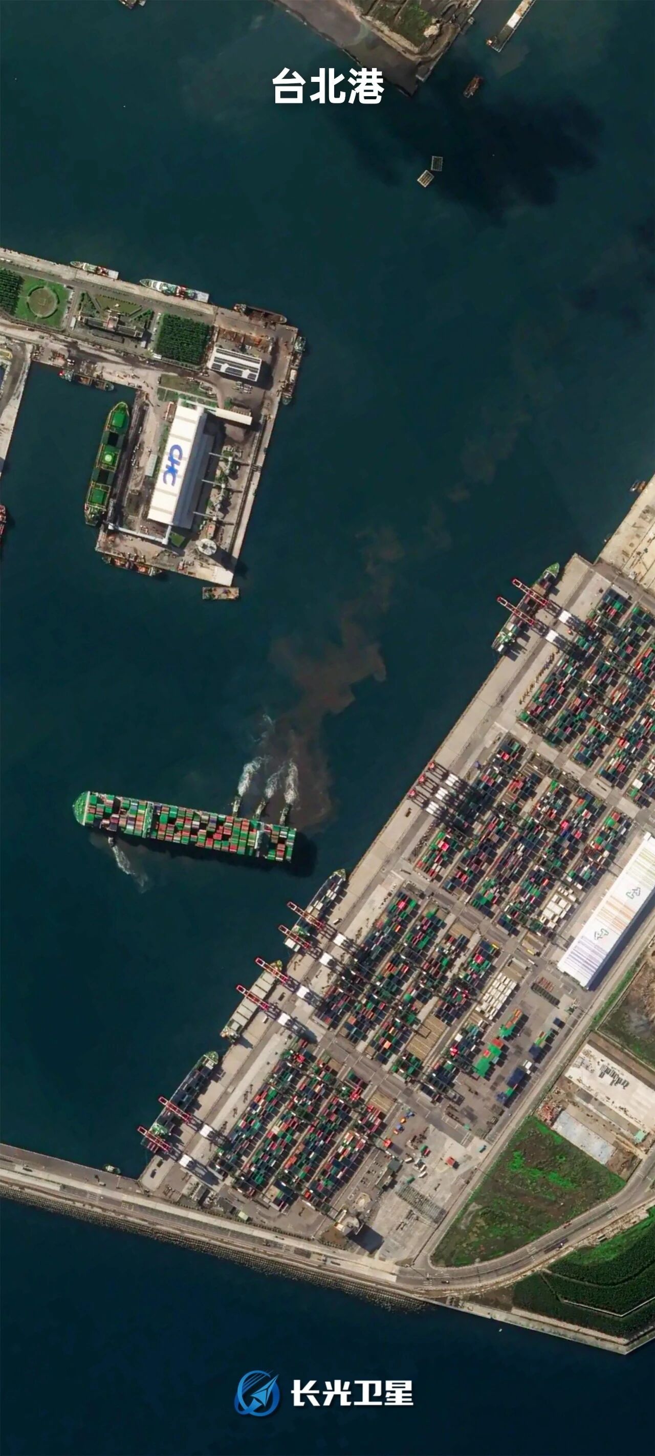
A satellite image of Port of Taipei in China's Taiwan region, captured by Jilin-1. /Chang Guang Satellite Technology
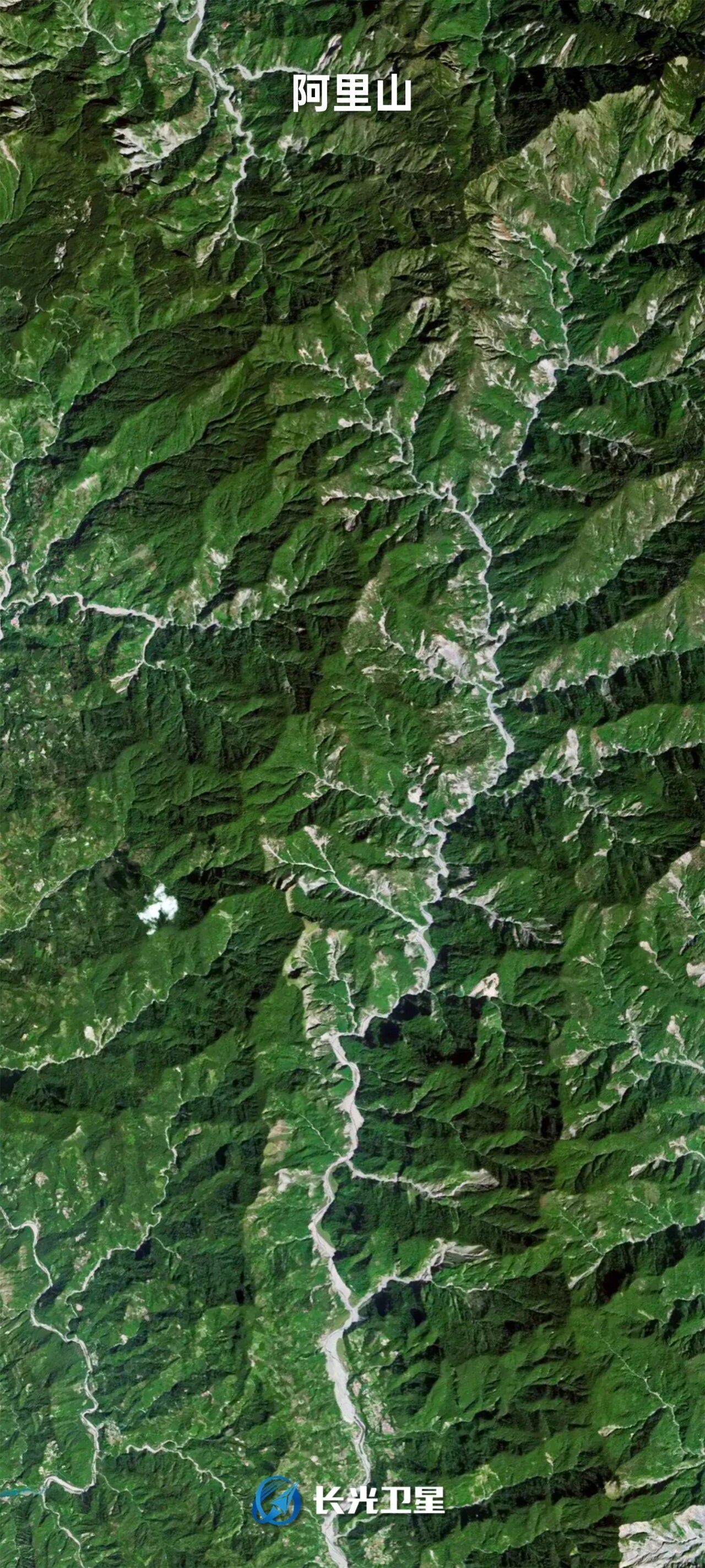
A satellite image of Alishan Mountain in China's Taiwan region, captured by Jilin-1. /Chang Guang Satellite Technology
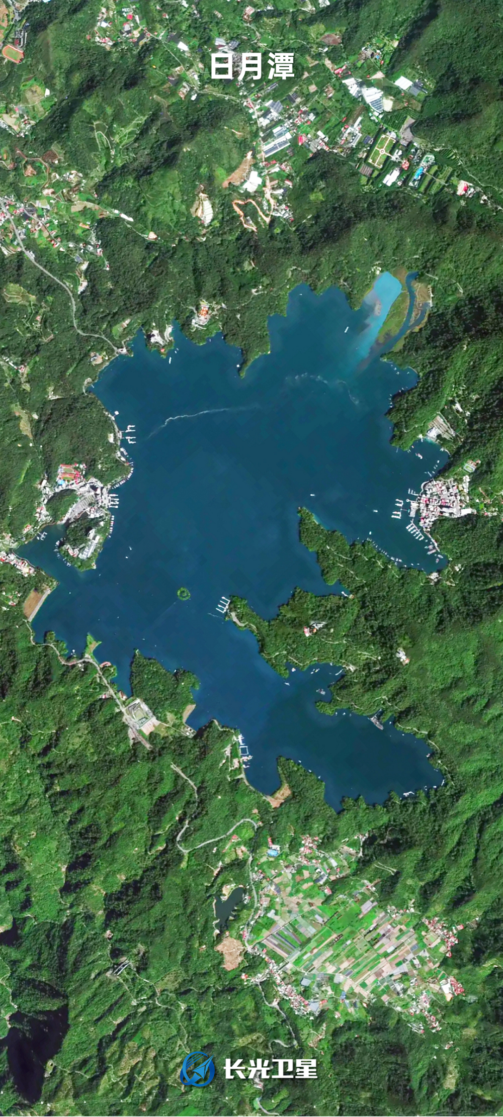
A satellite image of the Sun Moon Lake in China's Taiwan region, captured by Jilin-1. /Chang Guang Satellite Technology
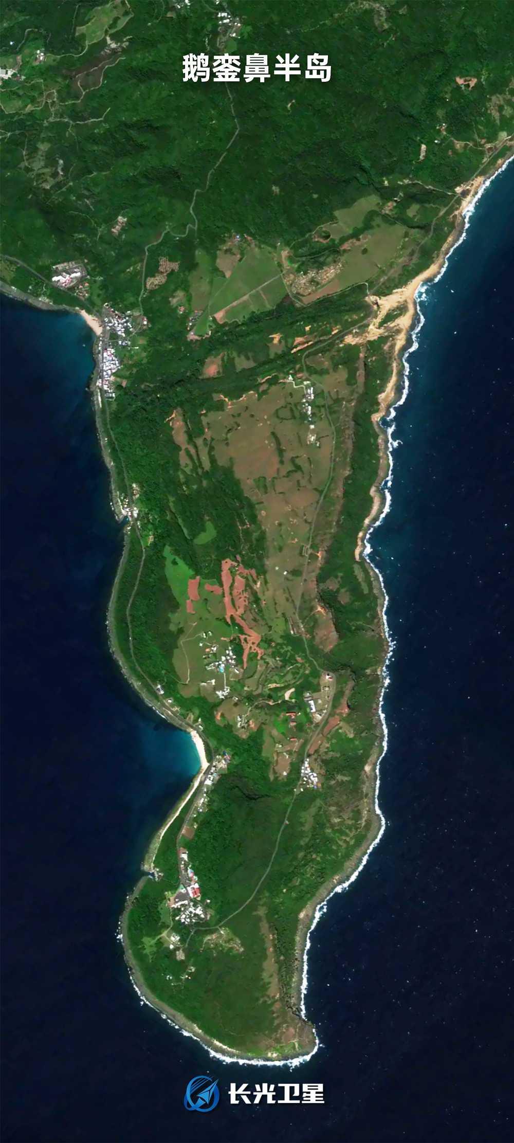
A satellite image of the Eluanbi Peninsula in China's Taiwan region, captured by Jilin-1. /Chang Guang Satellite Technology

A satellite image of the Keelung River in China's Taiwan region, captured by Jilin-1. /Chang Guang Satellite Technology
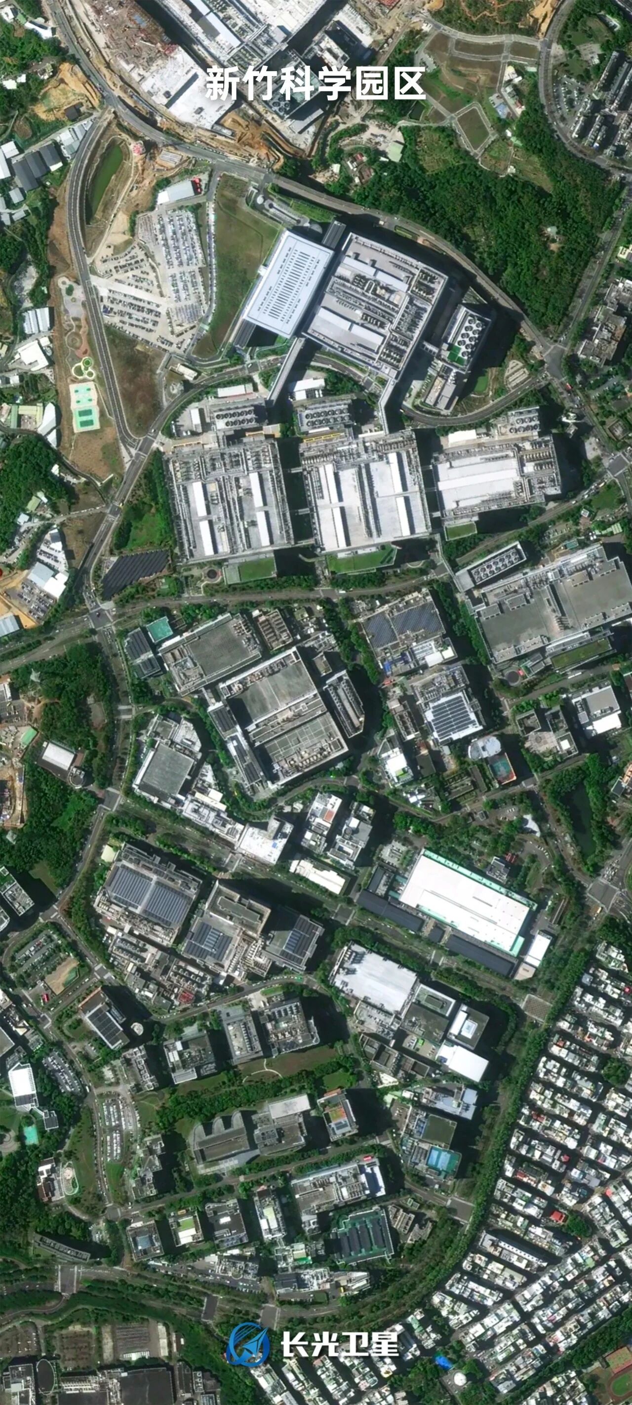
A satellite image of the Hsinchu Science Park in China's Taiwan region, captured by Jilin-1. /Chang Guang Satellite Technology
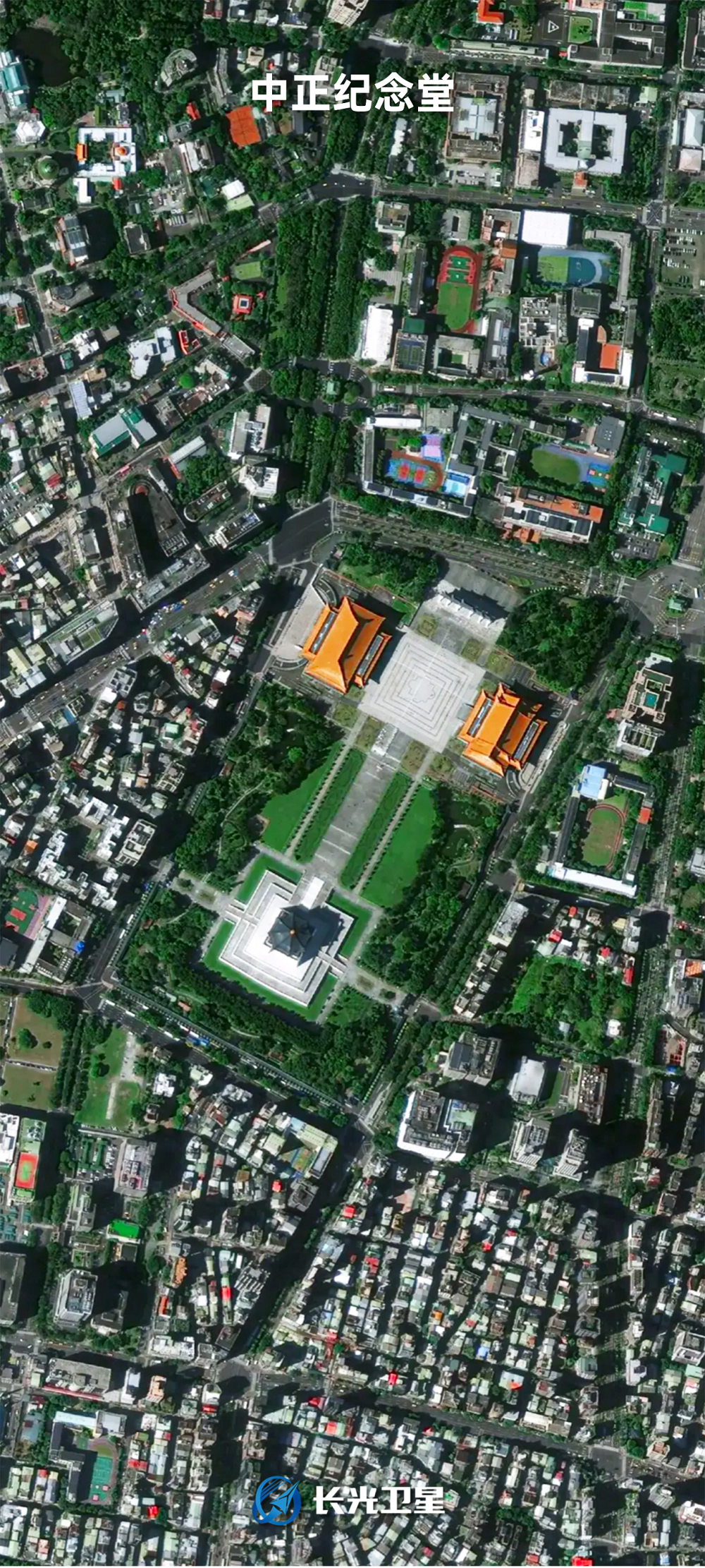
A satellite image of the Chiang Kai-Shek Memorial Hall in China's Taiwan region, captured by Jilin-1. /Chang Guang Satellite Technology
Search Trends
SITEMAP
Copyright © 2023 CGTN. 京ICP备16065310号

Disinformation report hotline: 010-85061466
SITEMAP
Copyright © 2023 CGTN. 京ICP备16065310号
Disinformation report hotline: 010-85061466