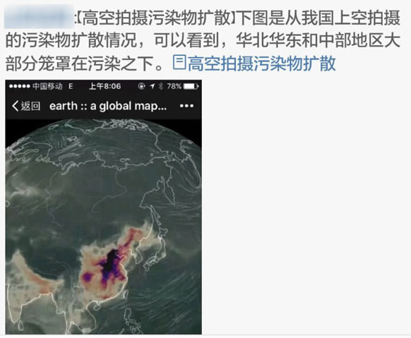


"Fake" satellite photo showing China's air pollution is spread online. /Snapshot from Sina Weibo

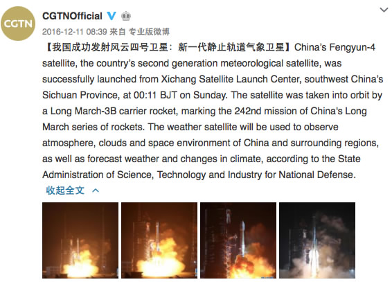
A snapshot form CGTN@Weibo announcing the successful launch of Fengyun-4. /Screenshot from Sina Weibo

Zhang Xingying, leading Chinese meteorologist.
ZHANG: Yes, the Fengyun-4 is one of the few geostationary satellites in the world equipped with a high resolution and aerosol-sensitive sensor to actually “see the smog” in the air. A resolution of 500 meters means it could trace pollution sources on a more refined scale, such as from factories. Also, this multi-channel sensor could detect the thickness of aerosol layers, functioning like a CT scanner.

The orbits of geostationary and polar-orbiting satellites. /Photo by David Babb
There are a lot of polar orbiting satellites flying at lower altitudes who can do that too, but they sweep over the surface of the ground only once a day. I was using all of them to detect air pollution in China, but could only get about two chances to spot the pollution in a single day. However, the Fengyun-4 is flying in a geostationary orbit at an altitude of over 35,000 km, which means it remains locked onto Chinese territory, and can take consecutive pictures in a sequence of every 15 minutes. Then, you can see what a significant improvement it is. We can now make an animation to demonstrate the emission and movement of air pollution! Japan’s Himawari 8, which was launched in 2014, used to be the only geostationary satellite capable of aerosol inspection in the world. But it is located above Japan, and couldn’t reach the middle and western parts of China. That’s why the Fengyun-4 means a lot to us.
ZHANG: First, all primary meteorological forecasts start with a computer calculation system using a certain model to deduce a possible outcome. But the results need to be adjusted consistently by human forecasters using their own judgement, which is based largely on the real-time inspection of the current situation. The satellite's feedback strongly supports that purpose. What’s more, data from some ground-based inspection spots that record air pollution is not shared, due to reasons such as local protectionism. The Fengyun-4 will offer us a fuller and more objective picture than what we can get right now.

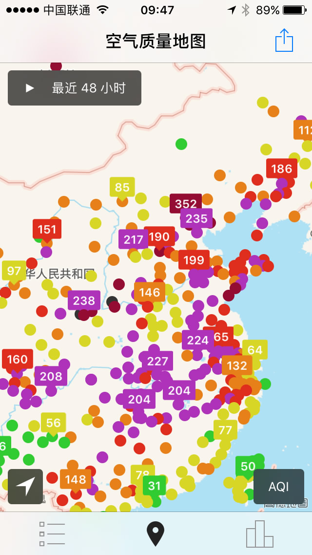
An "air pollution map" of January 4 based on ground measurement.
Second, the computer model used for meteorological forecasts needs to digest primary data. In the case of air pollution, that means two things: one, an original figure representing quantitative amounts of the pollution generated in a certain area during a certain period of time, and two; a forecast of weather conditions to see how quickly the pollution can be dissipated. The major problem lies with the first condition. In China, that figure is a fixed number calculated years ago based on the consumption of coal, electricity, and gas at that time, and it has not been updated for a long time. In contrast, the data in Europe and US is adjusted simultaneously with the feedback of satellites and ground-based inspections. That’s the main reason that causes the current inaccuracy of China’s pollution forecasts.

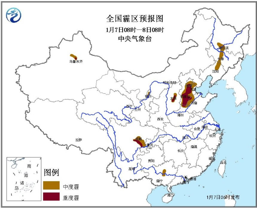
A smog alert issued by NMC saying there would be "medium" and "severe" smog from 8:00 a.m. January 7 to 8:00 a.m. January 8.
ZHANG: This brings us to the core of the problem, which I’ve been working on to solve. Even if you get all the inspection feedback on hand, how do you update the primary figure accordingly and scientifically? There, we need to use an advanced technological process called “assimilation,” and China is lagging behind in that domain. Take weather forecasts for example. The satellite data used there only accounts for 30 percent of the total amount, while that figure in Europe is 80 percent. When it comes to air pollution forecasts, no satellite data has been used in the official forecast for that reason so far. That’s why the current smog alerts could only be issued vaguely in the scale of days. Instead, the newest model that I developed in partnership with Europe "assimilated" all data available and can adjust the primary figure accordingly. That's why it could forecast China's air pollution much more precisely, in a time scale down to one hour.

Satellite data before and after assimilation offered by Zhang Xingying.
ZHANG: Yes, that’s a simple explanation.
ZHANG: I saw that picture and that’s exactly what I was talking about: the assimilation technology. NASA is quite skillful at it. Taking that picture for example, it is absolutely not the direct observation from any single satellite, but an integrated look from all satellites and ground-based data. As you can see, that model covers every corner of the planet. There is no gap. It’s impossible to get that from direct observation, even with all the satellites on hand. So they fill up the missing points using the data from satellite sweeps and nearby ground stations to make calculations, so that the resulting visualization looks smooth and impressive.

ZHANG: The data collected by Chinese weather satellites are always shared for free internationally, as it is in every country, and so will the data from Fengyun-4. As a state-funded institution, we focus on basic public services, including satellite data collection, analysis and sharing, and will leave later developments and applications to the market. Personally, I look forward to the future prospect of that domain.

Copyright © 2018 CGTN. Beijing ICP prepared NO.16065310-3
Copyright © 2018 CGTN. Beijing ICP prepared NO.16065310-3