
World
18:25, 28-Sep-2018
Indonesian city hit by tsunami after M7.5 earthquake
Updated
18:08, 01-Oct-2018
Share

Copied
A powerful 7.5-magnitude earthquake hit Indonesia's Sulawesi island at 10:02 GMT on Friday at a depth of 10 kilometers, causing a tsunami up to 2 meters high, the disaster agency said.
"A tsunami has happened in Palu," said Rahmat Triyono, head of the agency's earthquake and tsunami division, referring to Palu, a chartered city on the Indonesian island of Sulawesi.
The tsunami occurred after the tsunami warning was lifted by the country's national disaster agency.

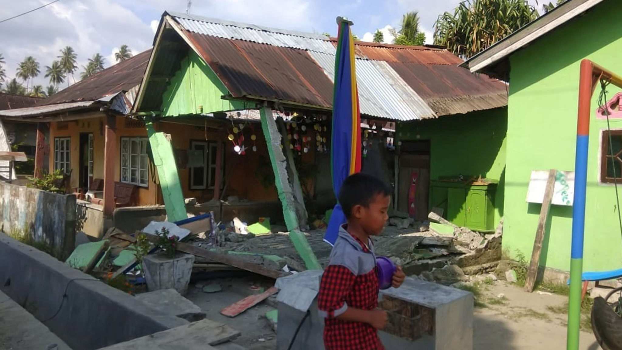
This handout photograph taken and released on September 28, 2018 by Indonesia's National Agency for Disaster Management (BNPB) shows a collapsed house following an M7.5 earthquake in Donggala, Central Sulawesi. /VCG Photo
This handout photograph taken and released on September 28, 2018 by Indonesia's National Agency for Disaster Management (BNPB) shows a collapsed house following an M7.5 earthquake in Donggala, Central Sulawesi. /VCG Photo
The United States Geological Survey (USGS) first put the scale at 7.7-magnitude but later revised it to 7.5.
This quake happened hours after another 6.1-magnitude earthquake hit the same island, where one person was killed and at least 10 others injured, some houses were also destroyed.
At least three aftershocks happened following the 7.5-magnitude quake within one hour, scaled at 5.8, 5.8, and 5.7 respectively.

This handout photograph taken and released on September 28, 2018 by Indonesia's National Agency for Disaster Management (BNPB) shows medical personnel giving medical care to a patient following an M7.5 earthquake in Donggala, Central Sulawesi. /VCG Photo
This handout photograph taken and released on September 28, 2018 by Indonesia's National Agency for Disaster Management (BNPB) shows medical personnel giving medical care to a patient following an M7.5 earthquake in Donggala, Central Sulawesi. /VCG Photo
There have been no immediate reports of deaths or injuries yet.
Indonesia is prone to quakes as it lies on a vulnerable quake-affected area popularly known as "the Pacific Ring of Fire."
4476km