TECH & SCI

Chinese satellite takes aerial pictures with one-meter ground resolution
2017-03-21 16:00:00 GMT+8
Editor
Gong Zhe
Chinese media widely reported on Monday that the country's latest imagery satellite - Gaojing-1 launched last December - has sent its pictures back to Earth.
Each dot in the images represents one square meter on the ground.
"The quality of the pictures is best in China, and top-class in the world," said the company that operates the satellite, China Aerospace Science and Technology Corporation (CASTC), on its official website.
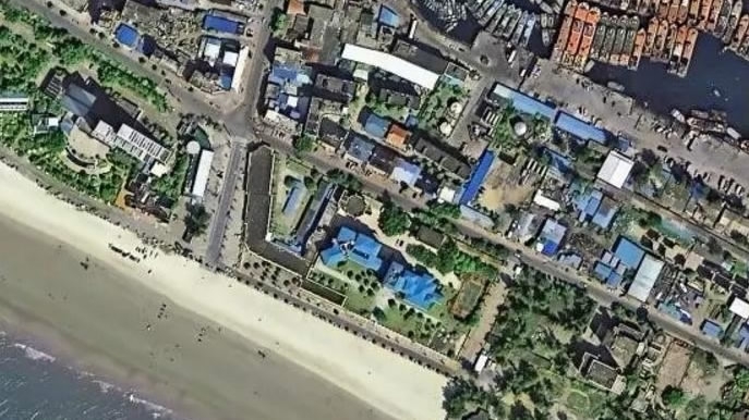
Gaojing-1's image of the Bell Tower in central Xi'an. /CASTIC
Acting as a commercial remote sensing satellite, Gaojing-1 can take more than 200 pictures a day, each covering an area of 4,200 square meters.
The published pictures include one of the areas around Dubai City Tower, in which the underwater facilities can be clearly seen.
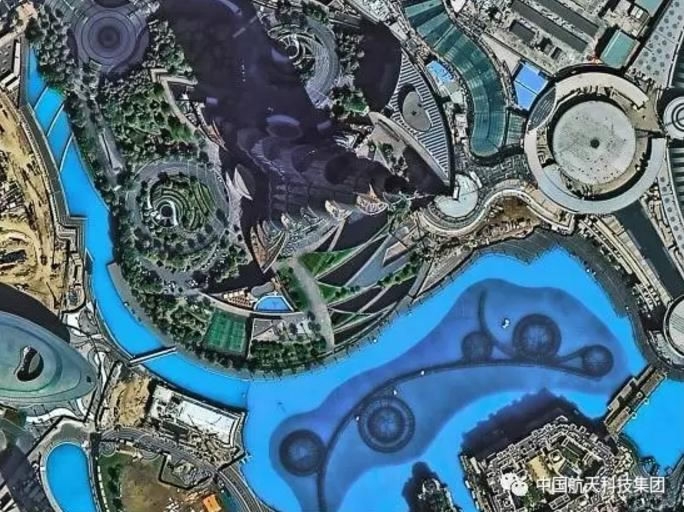
Gaojing-1's image of the Dubai City Tower. /CASTIC
Another picture shows the Ernst Happel Stadium in Austria's capital Vienna, in which the shadows of its structural steel bars seem very sharp.
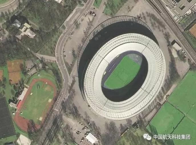
Gaojing-1's image of the Ernst Happel Stadium. /CASTIC
These pictures can be used in a variety of commercial areas, including navigation apps on smartphones.
Two more similar satellites will be launched by the end of the year, granting Chinese companies independence from foreign imagery technology, according to the company.
Copyright © 2017
SHARE


- EXPLORE
- MORE
FOLLOW US
