TECH & SCI

China releases first images from FY-4 satellite
2017-02-27 22:00 GMT+8
Editor
Gao Yun
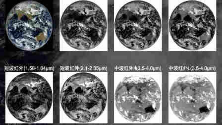
China's weather satellite, the Fengyun-4 Satellite (FY-4, literally “wind and cloud”), released the world’s first lightening detection images in geostationary orbit on Monday.
This first set of images was revealed by the lightening imaging sensor (LIS), a payload device on FY-4. It pictured a six-hour severe thunderstorm in the Swan Valley area of western Australia, showing the whole process from the storm’s generation, development to the end.
Developed by the 508th Research Institute of China Aerospace Science and Technology Corporation, it is China’s first geostationary LIS, making a giant leap in the nation’s space-based lightening detection technology.
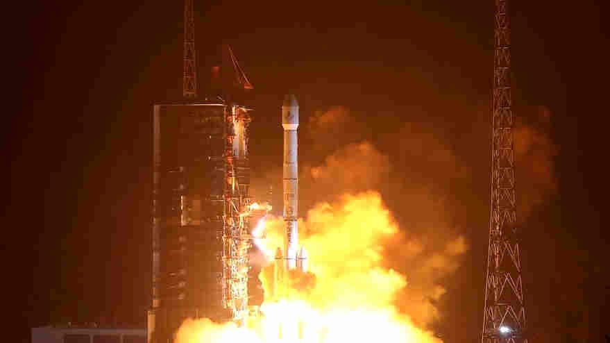
A Long March-3B rocket carrying the Fengyun-4 satellite blasts off from the launching pad at Xichang Satellite Launch Center, southwest China's Sichuan Province, December 11, 2016. /Xinhua Photo
The LIS on FY-4 is one of the three geostationary LISs developed globally, and is the first to release detection data. It detects the lightening situation covering the whole of China and surrounding areas every two milliseconds, and is able to conduct non-stop on-orbit lightening detection and monitoring for seven consecutive years. With a strong capability to detect lightening, it conducts real-time monitoring of cloud movements and convection air mass movements, and obtains high-quality ground images at a speed of six frames per second.
Lightening detection together with cloud maps can provide short time and real time forecast and warning of lightning strikes, as well as severe convection weather, decreasing the damage caused by thunder or convection weather to aviation, navigation, agriculture, forestry, electricity and many other industries.
Launched last December, the FY-4 satellite is the first of China's second-generation geostationary weather satellites, and also its first quantitative remote-sensing satellite in high orbit.
Copyright © 2017
SHARE


- EXPLORE
- MORE
FOLLOW US
