- Home
- China
- World
- Asia-Pacific
- Americas
- Europe
- Middle-East and Africa
- Politics
- Business
- Opinions
- Tech & Sci
- Culture
- Sports
- Travel
- Nature
- Picture
- Video
- Live
- TV
- Specials
- Learn Chinese

Share

Copied
China's Ministry of Natural Resources on Monday published a landform survey report on the Diaoyu Island and its affiliated islands.
The report was issued after Japanese Prime Minister Yoshihide Suga prompted the Joe Biden administration to commit the applicability of the Japan-U.S. security treaty over the Diaoyu Islands during his first visit to the U.S. earlier this month.
Read more:
China warns Japan not to stir up trouble on Diaoyu Island issue
China denounces Japan's irresponsible remarks on Diaoyu Islands, Taiwan
Based on historical data, the survey obtained new terrain data of the Diaoyu Island and its affiliated islands, as well as the terrain data of waters 30 meters or less in depth, using technology such as satellite remote sensing.
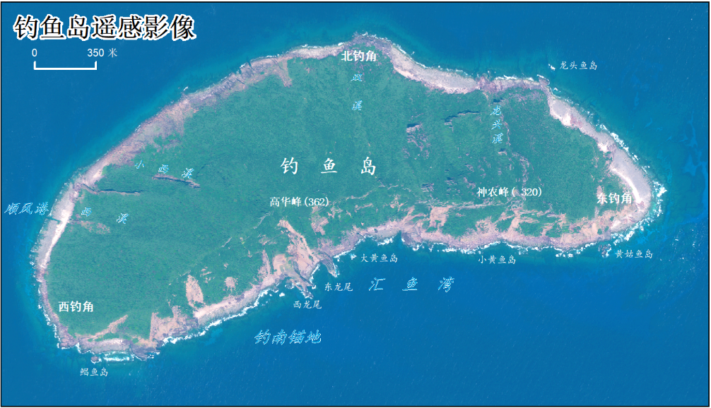
A satellite remote sensing image of the Diaoyu Island released by the latest landform survey report. /China's Ministry of Natural Resources
The report also made large-scale topographical thematic maps of the Diaoyu Island and its affiliated islands, improving basic geographic data of the area.
The survey is of great significance to the resource management and ecological environment protection of the Diaoyu Island and its affiliated islands, according to the report.
China has reiterated that the Diaoyu Island and its affiliated islands are an inherent part of China's territory and China's patrols and law-enforcement activities in waters off the Diaoyu Islands are an exercise of its inherent rights.
(With input from Xinhua)
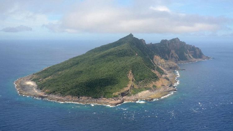
(Cover: China's Diaoyu Islands in the East China Sea. /Xinhua)