- Home
- China
- World
- Asia-Pacific
- Americas
- Europe
- Middle-East and Africa
- Politics
- Business
- Opinions
- Tech & Sci
- Culture
- Sports
- Travel
- Nature
- Picture
- Video
- Live
- TV
- Specials
- Learn Chinese

Share

Copied
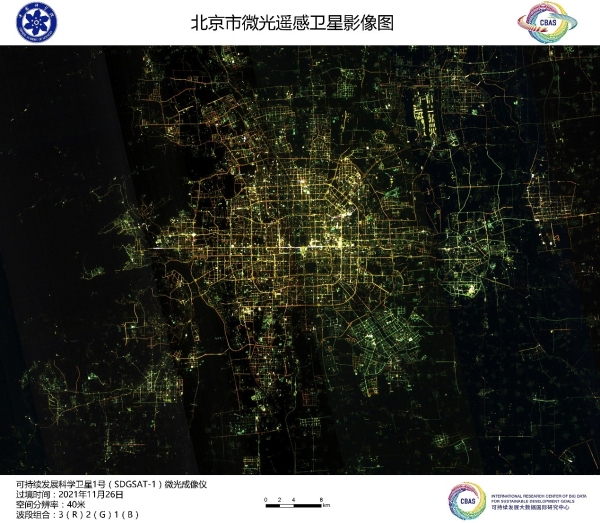
A glimmer image of Beijing, China, taken by the satellite SDGSAT-1, November 26, 2021. /International Research Center of Big Data for Sustainable Development Goals
A group of images taken by Chinese satellite SDGSAT-1 to help meet UN Sustainable Development Goals (SDGs) was unveiled in Beijing on Monday.
It was the first time images from the satellite were released since its launch on November 5 from Taiyuan Satellite Launch Center, north China's Shanxi Province.
SDGSAT-1 used three different imagers to take remote sensing pictures, showing the population density in the cities of Beijing, Shanghai and Paris, and environmental conditions in places including the Yangtze River Delta in eastern China and Lake Namtso on the Qinghai-Tibet Plateau in southwestern China.
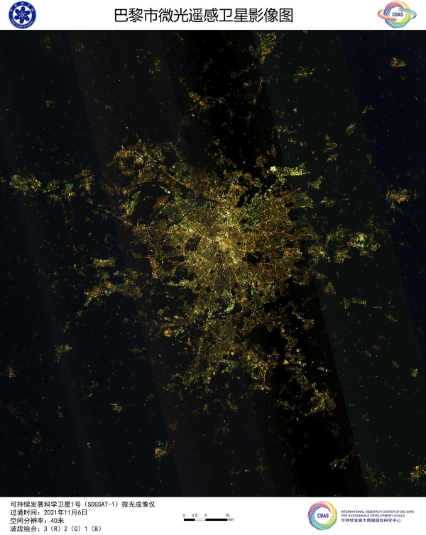
A glimmer image of Paris, France, taken by the satellite SDGSAT-1, November 26, 2021. /International Research Center of Big Data for Sustainable Development Goals
It is the world's first satellite to help realize 17 goals in the "2030 Agenda for Sustainable Development" set by the UN in 2015 to stimulate actions in solving social, economic and environmental problems for humanity and the planet.
The photos were shot by the satellite's thermal infrared, glimmer and multispectral imagers, which can work in multiple modes and all-weather conditions to precisely observe environmental changes on Earth linked to human activities like urbanization, habitation and energy consumption.
The glimmer imager showed the level of socioeconomic development and the population pattern, according to a press release by the Chinese Academy of Sciences (CAS), the host of the science project, which released the images on Monday.
It has one panchromatic band and three color bands with spatial resolutions of 10 and 40 meters. Its data, combined with business, social and humanities data, can aid in the accomplishment of UN SDGs related to building sustainable cities and communities as well as protection of underwater creatures.
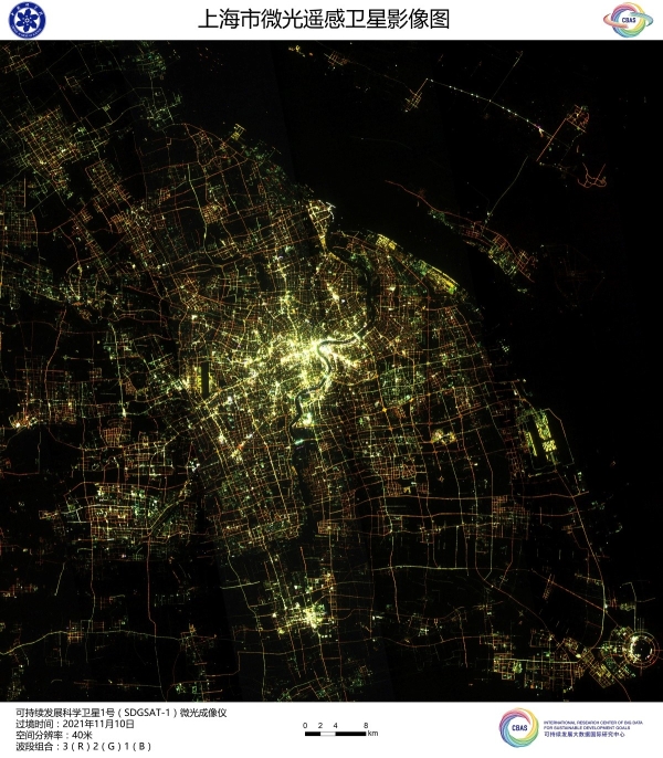
A glimmer image of Shanghai, China, taken by the satellite SDGSAT-1, November 26, 2021. /International Research Center of Big Data for Sustainable Development Goals
The multispectral imager has seven bands and a spatial resolution of 10 meters. The CAS said data through such an imager with high Signal Noise Ratio (SNR) would help in monitoring water quality, coastal ecosystems, glacier changes and land creatures.
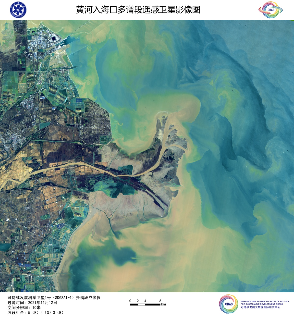
A multispectral image of the Yellow River flowing into the Bohai sea in eastern China's Shandong Province taken by the satellite SDGSAT-1, November 26, 2021. /International Research Center of Big Data for Sustainable Development Goals
The thermal infrared imager has the new design of three bands and a spatial resolution of 30 meters. Its working width is some 300 kilometers and it can detect temperature differences of 0.2 degree Celsius.
A thermal infrared image of Aqsu in Xinjiang Uygur Autonomous Region, China, taken by the satellite SDGSAT-1, November 26, 2021. /International Research Center of Big Data for Sustainable Development Goals
The CAS said that it can be used to precisely monitor the surface temperature of land and water, and offer basic data for crop growth, energy consumption, and pest and disease occurrence prediction.
(CGTN's Liu Wei also contributed to the story.)