
Trasnport
14:45, 01-Jan-2018
How hard it is for a highway to pierce through 2km high mountains?
Share

Copied
A new highway was opened in southwestern China on Sunday, connecting the Tibet Plateau with lower grounds.
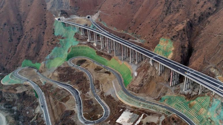
The highway, which is about 100 kilometers long, demonstrates the skill of Chinese engineers and workers as the road had to be built between extremely high mountains and deep valleys.
At the west end of the Ya'an-Kangding highway is Kangding city, which is 2,500 meters higher than the east end at Ya'an.
And the road goes through one of the highest mountains in the world: The Hengduan Mountain.
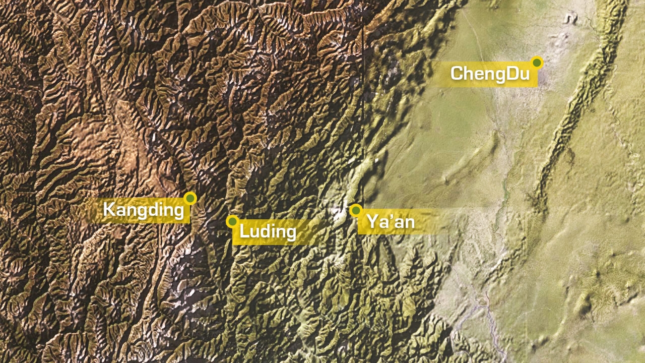
A map of the elevation in the area. The highest point on the left mountainous area is above 5,000 meters, while the plain on the right is only 500 meters above sea level. /CGTN Photo
A map of the elevation in the area. The highest point on the left mountainous area is above 5,000 meters, while the plain on the right is only 500 meters above sea level. /CGTN Photo
Hengduan stands roughly 1,500 kilometers to the east of the Himalayas. The name "Hengduan" literally means "total blockage" in Chinese.
More than 82 percent of the highway is made of bridges and tunnels designed to smooth the steep cliffs along the way, making it one of the hardest engineering projects in China.

A total of 40,000 LED lights were installed in the tunnels to keep the drivers focused. /Chinanews.com Photo
A total of 40,000 LED lights were installed in the tunnels to keep the drivers focused. /Chinanews.com Photo
Ready to be rocked
Another problem with roads in the area is ground movement. The highway is located not far away from Wenchuan City, the epicenter of China's worst earthquake in the last decade, which killed nearly 70,000 people on May 12, 2008.
Transportation is one of the keys for earthquake rescue and the engineers of the new highway made use of China's latest technology to monitor the ground movement.
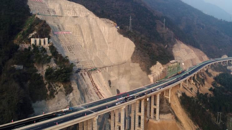
Road restored after landslide /Chinanews.com Photo
Road restored after landslide /Chinanews.com Photo
A total of 72 monitor sites were installed along the road, all equipped with Beidou satellite positioning chips.
Any ground movement further than 2.5 millimeters will trigger alerts, according to Huang Bing, CEO of the company that runs the road.
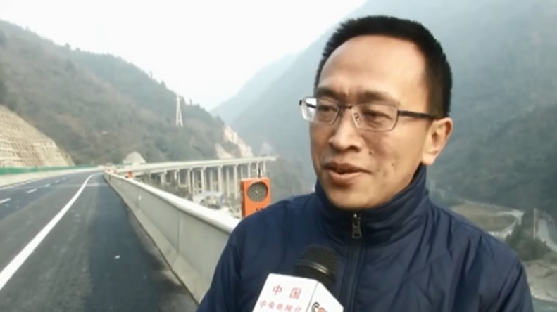
Huang Bing talks with CCTV reporters by the highway. /Screenshot from CCTV
Huang Bing talks with CCTV reporters by the highway. /Screenshot from CCTV
The Ya'an-Kangding highway is part of the national G4218 highway, which is the first of its kind to reach the Tibetans in Sichuan Province. The road is expected to bring faster economic growth and benefit the people.
"I'm very happy with the highway," Yang Tianzhi, an intercity bus driver, told CCTV. "I can say goodbye to the old, cliffy and snowy road now."
The highway is an addition to the existing Sichuan-Tibet railway, offering another option for traveling between Sichuan and Tibet, both in southwest China.