03:21

Editor's note: As "green development" is an important aspect of China's 14th Five-Year Plan development blueprint, the country has stepped up its environmental protection efforts. The Sanjiangyuan area in northwest China's Qinghai Province holds a unique role as a "water tower" with rich biodiversity. As the area has been turned into a national park, which shows China's determination in this regard, CGTN's Yang Jinghao travels there to record the changes seen there and the efforts behind them.
Modern technology is playing an increasingly important role in the conservation of Sanjiangyuan, as China steps up efforts in the pure land sitting on the Qinghai-Tibet Plateau, hailed as the "roof of the world," especially after the landmark move to establish a national park there.
Sanjiangyuan, meaning source of the three rivers, refers to a vast area in northwest China's Qinghai Province. It's home to the country's three great rivers – the Yangtze, Yellow, and Lancang rivers.
"We need to manage the national park with strong technological support," He Wancheng, chief of the Sanjiangyuan National Park Administration, told CGTN. "First, we'll do research to determine the optimal measures to protect designated areas and improve their functionality."

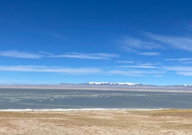
Hoh Xil National Nature Reserve, one of China's largest no man's lands, constitutes a major part of the Sanjiangyuan National Park in northwest China's Qinghai Province. Yang Jinghao/CGTN
Hoh Xil National Nature Reserve, one of China's largest no man's lands, constitutes a major part of the Sanjiangyuan National Park in northwest China's Qinghai Province. Yang Jinghao/CGTN
In 2004, the Sanjiangyuan National Nature Reserve was set up to restore and better protect the ecological environment of the region, which is known for rich biodiversity. So far, more than $3.6 billion have been spent on the ambitious campaign. At China's first national park, which is still a pilot project, greater importance has been attached to application of technologies.
The park covers an area of more than 12 million hectares, posing a great challenge for the authorities to conduct effective surveillance. But experts say remote sensing technology makes the work a lot easier.
"We've captured over 4,000 satellite images. Through periodic monitoring, we can get a clear understanding of related indexes and the ecological changes in the region over a period of time," said Wang Jian, chief designer of the ecology and environment field of the Space Star Technology Company, which collaborates with the national park's administration to facilitate its management.

Authorities can learn about ecological changes of the region through data collected by remote sensing satellites. Luo Caiwen/CGTN
Authorities can learn about ecological changes of the region through data collected by remote sensing satellites. Luo Caiwen/CGTN
"It would take quite a long time to check through all the natural and mineral resources in the region with manpower solely," he said.
But manpower is also an indispensable force. Hundreds of rangers work in Sanjiangyuan all year round to patrol for trespassers who might come for poaching or illegal mining. For rangers, apart from the harsh natural conditions, the isolation with the outside in some no man's lands world makes their routine patrols even harder. The satellite communication technology is changing everything though.
The reporter followed some rangers on a patrol mission to Hoh Xil National Nature Reserve, one of the largest no man's lands in China, and learned that such an area can have internet access through a portable satellite communication system.
"This domestically made system functions with the transmission of video, voice and data, and with it, rangers can transmit the data they collect to authorities in real time," Zhang Qianliang, an engineer with the Space Technology Company, told CGTN.
Many protection stations where the rangers live are also equipped with stationary types so they can communicate with authorities easily, said Zhang.

Technicians show CGTN Tibetan antelopes inhabiting the Sanjiangyuan National Park through a big data platform. Luo Caiwen/CGTN
Technicians show CGTN Tibetan antelopes inhabiting the Sanjiangyuan National Park through a big data platform. Luo Caiwen/CGTN
With data collected through a combination of satellites, drones and cameras, a big data platform has also been set up at the administration. Through the platform, the management can monitor the natural resources and wildlife as well as the status of law enforcement conveniently.
Next, more technologies are expected to be applied, such as the indigenous BeiDou navigation satellite system.
"As the BeiDou system has the function of sending short messages, with a terminal, we can get to know the rangers' patrol routes and whereabouts. It's important to ensure their safety and become aware of on-site information in a timely fashion," Wang explained.
For more:
Exploring Sanjiangyuan: China's efforts to conserve river resources
Exploring Sanjiangyuan: Conservation efforts allow Hoh Xil wildlife to prosper
Exploring Sanjiangyuan: Herders engaged as guardians of Sanjiangyuan
Exploring Sanjiangyuan: Relocated herders find ways to preserve home, traditions
Exploring Sanjiangyuan: NGOs play crucial role in conserving ecology
(Cover photo: An engineer from the Space Star Technology Company installs a portable satellite communication device in the no man's land in Hoh Xil. Luo Caiwen/CGTN)
(If you want to contribute and have specific expertise, please contact us at nature@cgtn.com.)

